You are here: Home > Network List > IU - Global Seismograph Network (GSN - IRIS/USGS) Stations List
> Station FURI Mt. Furi, Ethiopia > Earthquake Result Viewer
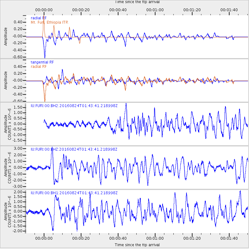
FURI Mt. Furi, Ethiopia - Earthquake Result Viewer
*The percent match for this event was below the threshold and hence no stack was calculated.
| Earthquake location: |
Central Italy |
| Earthquake latitude/longitude: |
42.7/13.2 |
| Earthquake time(UTC): |
2016/08/24 (237) 01:36:33 GMT |
| Earthquake Depth: |
10 km |
| Earthquake Magnitude: |
6.2 MWP |
| Earthquake Catalog/Contributor: |
NEIC PDE/NEIC COMCAT |
|
| Network: |
IU Global Seismograph Network (GSN - IRIS/USGS) |
| Station: |
FURI Mt. Furi, Ethiopia |
| Lat/Lon: |
8.90 N/38.68 E |
| Elevation: |
2570 m |
|
| Distance: |
40.4 deg |
| Az: |
139.002 deg |
| Baz: |
330.704 deg |
| Ray Param: |
$rayparam |
*The percent match for this event was below the threshold and hence was not used in the summary stack. |
|
| Radial Match: |
81.40944 % |
| Radial Bump: |
400 |
| Transverse Match: |
82.26413 % |
| Transverse Bump: |
400 |
| SOD ConfigId: |
1634031 |
| Insert Time: |
2016-09-07 01:39:11.293 +0000 |
| GWidth: |
2.5 |
| Max Bumps: |
400 |
| Tol: |
0.001 |
|
Signal To Noise
| Channel | StoN | STA | LTA |
| IU:FURI:00:BHZ:20160824T01:43:41.218998Z | 8.534479 | 1.1586917E-6 | 1.3576596E-7 |
| IU:FURI:00:BH1:20160824T01:43:41.218998Z | 4.5274663 | 6.246756E-7 | 1.3797465E-7 |
| IU:FURI:00:BH2:20160824T01:43:41.218998Z | 1.3958923 | 2.0860567E-7 | 1.4944254E-7 |
| Arrivals |
| Ps | |
| PpPs | |
| PsPs/PpSs | |


