You are here: Home > Network List > TS - TERRAscope (Southern California Seismic Network) Stations List
> Station BAR Barrett Dam, California, USA > Earthquake Result Viewer
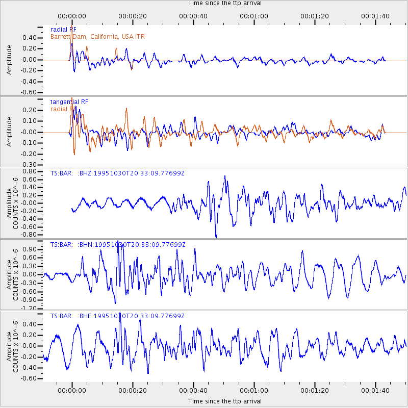
BAR Barrett Dam, California, USA - Earthquake Result Viewer
*The percent match for this event was below the threshold and hence no stack was calculated.
| Earthquake location: |
Andreanof Islands, Aleutian Is. |
| Earthquake latitude/longitude: |
51.7/-173.4 |
| Earthquake time(UTC): |
1995/10/30 (303) 20:25:28 GMT |
| Earthquake Depth: |
33 km |
| Earthquake Magnitude: |
5.4 MB, 5.3 MS, 5.8 UNKNOWN, 5.6 ML |
| Earthquake Catalog/Contributor: |
WHDF/NEIC |
|
| Network: |
TS TERRAscope (Southern California Seismic Network) |
| Station: |
BAR Barrett Dam, California, USA |
| Lat/Lon: |
32.68 N/116.67 W |
| Elevation: |
548 m |
|
| Distance: |
44.9 deg |
| Az: |
92.205 deg |
| Baz: |
312.472 deg |
| Ray Param: |
$rayparam |
*The percent match for this event was below the threshold and hence was not used in the summary stack. |
|
| Radial Match: |
61.81267 % |
| Radial Bump: |
400 |
| Transverse Match: |
62.577347 % |
| Transverse Bump: |
400 |
| SOD ConfigId: |
4480 |
| Insert Time: |
2010-02-26 14:01:19.216 +0000 |
| GWidth: |
2.5 |
| Max Bumps: |
400 |
| Tol: |
0.001 |
|
Signal To Noise
| Channel | StoN | STA | LTA |
| TS:BAR: :BHN:19951030T20:33:09.77699Z | 1.7317364 | 2.2147323E-7 | 1.2789084E-7 |
| TS:BAR: :BHE:19951030T20:33:09.77699Z | 1.6709679 | 2.5200828E-7 | 1.5081575E-7 |
| TS:BAR: :BHZ:19951030T20:33:09.77699Z | 1.4704351 | 1.3071033E-7 | 8.889228E-8 |
| Arrivals |
| Ps | |
| PpPs | |
| PsPs/PpSs | |


