You are here: Home > Network List > TJ - Tajikistan National Seismic Network Stations List
> Station GARM Garm, Tajikistan > Earthquake Result Viewer
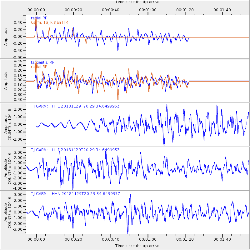
GARM Garm, Tajikistan - Earthquake Result Viewer
*The percent match for this event was below the threshold and hence no stack was calculated.
| Earthquake location: |
Northern Sumatra, Indonesia |
| Earthquake latitude/longitude: |
0.3/97.0 |
| Earthquake time(UTC): |
2018/11/29 (333) 20:21:44 GMT |
| Earthquake Depth: |
8.8 km |
| Earthquake Magnitude: |
5.7 Mww |
| Earthquake Catalog/Contributor: |
NEIC PDE/us |
|
| Network: |
TJ Tajikistan National Seismic Network |
| Station: |
GARM Garm, Tajikistan |
| Lat/Lon: |
39.00 N/70.32 E |
| Elevation: |
1305 m |
|
| Distance: |
45.7 deg |
| Az: |
330.669 deg |
| Baz: |
141.049 deg |
| Ray Param: |
$rayparam |
*The percent match for this event was below the threshold and hence was not used in the summary stack. |
|
| Radial Match: |
70.88184 % |
| Radial Bump: |
400 |
| Transverse Match: |
61.356625 % |
| Transverse Bump: |
400 |
| SOD ConfigId: |
13570011 |
| Insert Time: |
2019-05-01 23:09:59.625 +0000 |
| GWidth: |
2.5 |
| Max Bumps: |
400 |
| Tol: |
0.001 |
|
Signal To Noise
| Channel | StoN | STA | LTA |
| TJ:GARM: :HHZ:20181129T20:29:34.649995Z | 2.5206037 | 9.3096895E-7 | 3.6934364E-7 |
| TJ:GARM: :HHN:20181129T20:29:34.649995Z | 2.8485262 | 6.5624914E-7 | 2.30382E-7 |
| TJ:GARM: :HHE:20181129T20:29:34.649995Z | 2.428186 | 6.0036257E-7 | 2.4724736E-7 |
| Arrivals |
| Ps | |
| PpPs | |
| PsPs/PpSs | |


