You are here: Home > Network List > TA - USArray Transportable Network (new EarthScope stations) Stations List
> Station H21A Big Horn, Sheridan, WY, USA > Earthquake Result Viewer
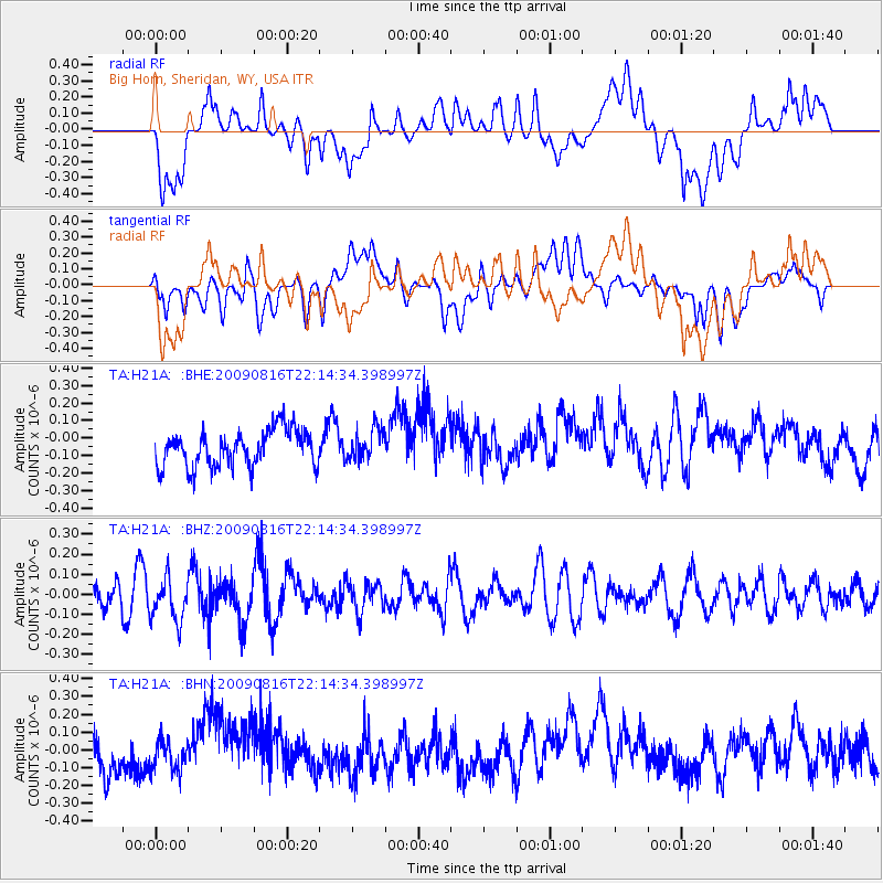
H21A Big Horn, Sheridan, WY, USA - Earthquake Result Viewer
*The percent match for this event was below the threshold and hence no stack was calculated.
| Earthquake location: |
Fiji Islands Region |
| Earthquake latitude/longitude: |
-17.9/-179.4 |
| Earthquake time(UTC): |
2009/08/16 (228) 22:03:09 GMT |
| Earthquake Depth: |
626 km |
| Earthquake Magnitude: |
5.5 MW, 4.9 MB |
| Earthquake Catalog/Contributor: |
WHDF/NEIC |
|
| Network: |
TA USArray Transportable Network (new EarthScope stations) |
| Station: |
H21A Big Horn, Sheridan, WY, USA |
| Lat/Lon: |
44.63 N/107.04 W |
| Elevation: |
1411 m |
|
| Distance: |
90.5 deg |
| Az: |
42.881 deg |
| Baz: |
245.129 deg |
| Ray Param: |
$rayparam |
*The percent match for this event was below the threshold and hence was not used in the summary stack. |
|
| Radial Match: |
40.98274 % |
| Radial Bump: |
400 |
| Transverse Match: |
30.671406 % |
| Transverse Bump: |
400 |
| SOD ConfigId: |
2622 |
| Insert Time: |
2010-03-06 18:21:13.313 +0000 |
| GWidth: |
2.5 |
| Max Bumps: |
400 |
| Tol: |
0.001 |
|
Signal To Noise
| Channel | StoN | STA | LTA |
| TA:H21A: :BHZ:20090816T22:14:34.398997Z | 1.1411766 | 1.08414355E-7 | 9.5002264E-8 |
| TA:H21A: :BHN:20090816T22:14:34.398997Z | 0.69035023 | 8.422377E-8 | 1.2200152E-7 |
| TA:H21A: :BHE:20090816T22:14:34.398997Z | 0.83843887 | 8.7028596E-8 | 1.03798385E-7 |
| Arrivals |
| Ps | |
| PpPs | |
| PsPs/PpSs | |


