You are here: Home > Network List > TA - USArray Transportable Network (new EarthScope stations) Stations List
> Station H21A Big Horn, Sheridan, WY, USA > Earthquake Result Viewer
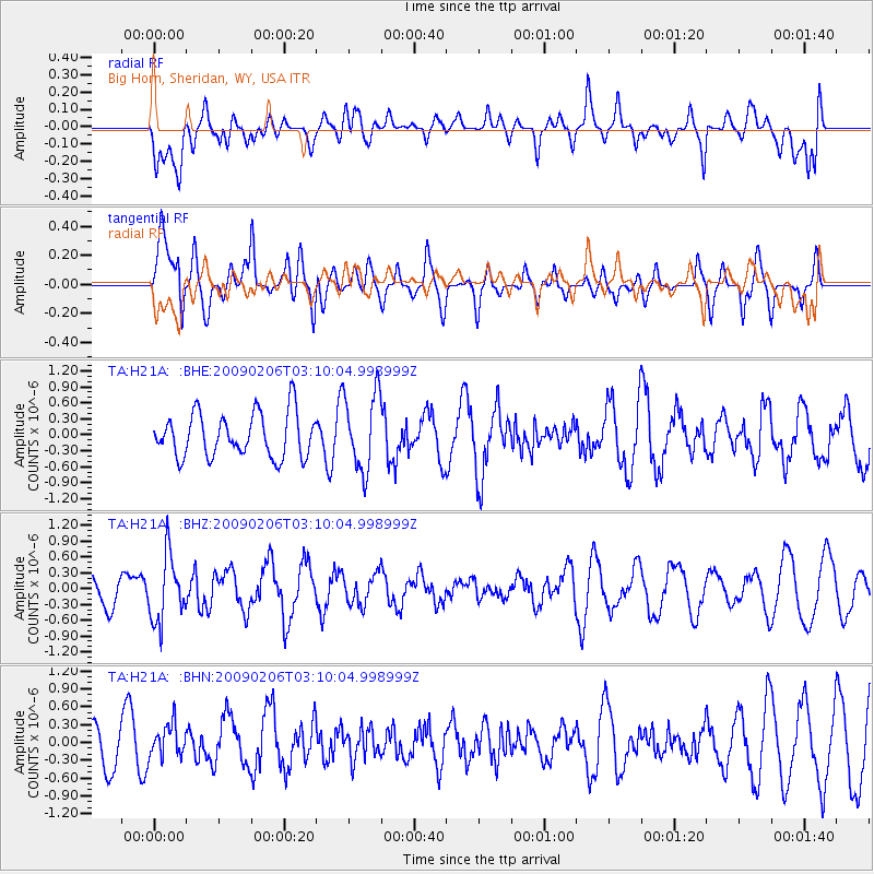
H21A Big Horn, Sheridan, WY, USA - Earthquake Result Viewer
*The percent match for this event was below the threshold and hence no stack was calculated.
| Earthquake location: |
Near Coast Of Northern Chile |
| Earthquake latitude/longitude: |
-28.0/-71.1 |
| Earthquake time(UTC): |
2009/02/06 (037) 02:58:35 GMT |
| Earthquake Depth: |
52 km |
| Earthquake Magnitude: |
5.5 MB |
| Earthquake Catalog/Contributor: |
WHDF/NEIC |
|
| Network: |
TA USArray Transportable Network (new EarthScope stations) |
| Station: |
H21A Big Horn, Sheridan, WY, USA |
| Lat/Lon: |
44.63 N/107.04 W |
| Elevation: |
1411 m |
|
| Distance: |
79.4 deg |
| Az: |
334.761 deg |
| Baz: |
148.123 deg |
| Ray Param: |
$rayparam |
*The percent match for this event was below the threshold and hence was not used in the summary stack. |
|
| Radial Match: |
55.81646 % |
| Radial Bump: |
400 |
| Transverse Match: |
57.843 % |
| Transverse Bump: |
400 |
| SOD ConfigId: |
2658 |
| Insert Time: |
2010-03-06 18:22:34.014 +0000 |
| GWidth: |
2.5 |
| Max Bumps: |
400 |
| Tol: |
0.001 |
|
Signal To Noise
| Channel | StoN | STA | LTA |
| TA:H21A: :BHZ:20090206T03:10:04.998999Z | 1.9875526 | 6.2033735E-7 | 3.1211115E-7 |
| TA:H21A: :BHN:20090206T03:10:04.998999Z | 1.1038128 | 2.7551627E-7 | 2.4960414E-7 |
| TA:H21A: :BHE:20090206T03:10:04.998999Z | 1.7784897 | 7.271166E-7 | 4.0883938E-7 |
| Arrivals |
| Ps | |
| PpPs | |
| PsPs/PpSs | |


