You are here: Home > Network List > TA - USArray Transportable Network (new EarthScope stations) Stations List
> Station H21A Big Horn, Sheridan, WY, USA > Earthquake Result Viewer
H21A Big Horn, Sheridan, WY, USA - Earthquake Result Viewer
*The percent match for this event was below the threshold and hence no stack was calculated.
| Earthquake location: |
Fiji Islands Region |
| Earthquake latitude/longitude: |
-20.8/-177.3 |
| Earthquake time(UTC): |
2009/02/11 (042) 09:31:04 GMT |
| Earthquake Depth: |
10 km |
| Earthquake Magnitude: |
5.5 MB, 5.2 MS, 5.5 MW, 5.5 MW |
| Earthquake Catalog/Contributor: |
WHDF/NEIC |
|
| Network: |
TA USArray Transportable Network (new EarthScope stations) |
| Station: |
H21A Big Horn, Sheridan, WY, USA |
| Lat/Lon: |
44.63 N/107.04 W |
| Elevation: |
1411 m |
|
| Distance: |
91.2 deg |
| Az: |
42.238 deg |
| Baz: |
241.757 deg |
| Ray Param: |
$rayparam |
*The percent match for this event was below the threshold and hence was not used in the summary stack. |
|
| Radial Match: |
44.38332 % |
| Radial Bump: |
400 |
| Transverse Match: |
48.369217 % |
| Transverse Bump: |
400 |
| SOD ConfigId: |
2658 |
| Insert Time: |
2010-03-06 18:22:36.805 +0000 |
| GWidth: |
2.5 |
| Max Bumps: |
400 |
| Tol: |
0.001 |
|
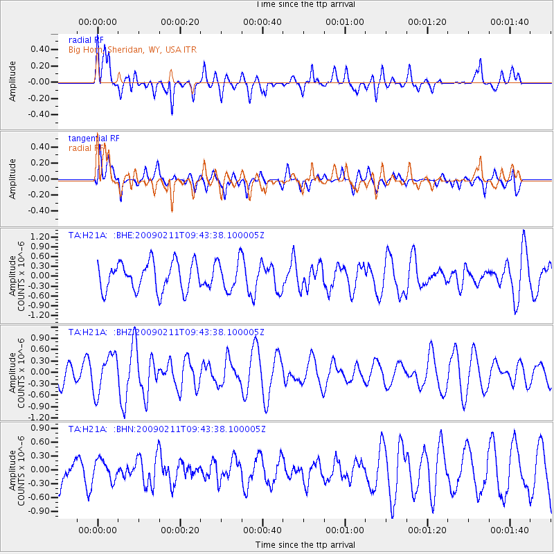
Signal To Noise
| Channel | StoN | STA | LTA |
| TA:H21A: :BHZ:20090211T09:43:38.100005Z | 2.2696576 | 5.134901E-7 | 2.2624123E-7 |
| TA:H21A: :BHN:20090211T09:43:38.100005Z | 0.72561836 | 2.17252E-7 | 2.9940256E-7 |
| TA:H21A: :BHE:20090211T09:43:38.100005Z | 1.0710949 | 4.6339707E-7 | 4.3263867E-7 |
| Arrivals |
| Ps | |
| PpPs | |
| PsPs/PpSs | |


