You are here: Home > Network List > TS - TERRAscope (Southern California Seismic Network) Stations List
> Station BAR Barrett Dam, California, USA > Earthquake Result Viewer
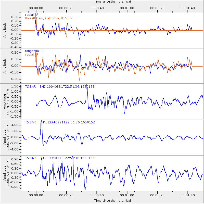
BAR Barrett Dam, California, USA - Earthquake Result Viewer
*The percent match for this event was below the threshold and hence no stack was calculated.
| Earthquake location: |
Fiji Islands Region |
| Earthquake latitude/longitude: |
-22.0/-179.6 |
| Earthquake time(UTC): |
1994/03/31 (090) 22:40:53 GMT |
| Earthquake Depth: |
591 km |
| Earthquake Magnitude: |
5.9 MB, 6.5 UNKNOWN, 6.5 MW |
| Earthquake Catalog/Contributor: |
WHDF/NEIC |
|
| Network: |
TS TERRAscope (Southern California Seismic Network) |
| Station: |
BAR Barrett Dam, California, USA |
| Lat/Lon: |
32.68 N/116.67 W |
| Elevation: |
548 m |
|
| Distance: |
81.0 deg |
| Az: |
49.484 deg |
| Baz: |
236.811 deg |
| Ray Param: |
$rayparam |
*The percent match for this event was below the threshold and hence was not used in the summary stack. |
|
| Radial Match: |
69.76025 % |
| Radial Bump: |
400 |
| Transverse Match: |
74.174 % |
| Transverse Bump: |
400 |
| SOD ConfigId: |
4480 |
| Insert Time: |
2010-02-26 14:01:25.940 +0000 |
| GWidth: |
2.5 |
| Max Bumps: |
400 |
| Tol: |
0.001 |
|
Signal To Noise
| Channel | StoN | STA | LTA |
| TS:BAR: :BHN:19940331T22:51:36.165015Z | 4.6691113 | 2.2461738E-6 | 4.810709E-7 |
| TS:BAR: :BHE:19940331T22:51:36.165015Z | 2.0658326 | 4.030803E-7 | 1.951176E-7 |
| TS:BAR: :BHZ:19940331T22:51:36.165015Z | 2.2920465 | 6.6608925E-7 | 2.9060894E-7 |
| Arrivals |
| Ps | |
| PpPs | |
| PsPs/PpSs | |


