You are here: Home > Network List > TS - TERRAscope (Southern California Seismic Network) Stations List
> Station BAR Barrett Dam, California, USA > Earthquake Result Viewer
BAR Barrett Dam, California, USA - Earthquake Result Viewer
*The percent match for this event was below the threshold and hence no stack was calculated.
| Earthquake location: |
Santa Cruz Islands |
| Earthquake latitude/longitude: |
-10.9/166.0 |
| Earthquake time(UTC): |
1996/09/14 (258) 13:10:53 GMT |
| Earthquake Depth: |
73 km |
| Earthquake Magnitude: |
6.0 MB, 6.0 MS, 6.4 UNKNOWN, 6.4 MW |
| Earthquake Catalog/Contributor: |
WHDF/NEIC |
|
| Network: |
TS TERRAscope (Southern California Seismic Network) |
| Station: |
BAR Barrett Dam, California, USA |
| Lat/Lon: |
32.68 N/116.67 W |
| Elevation: |
548 m |
|
| Distance: |
85.4 deg |
| Az: |
55.642 deg |
| Baz: |
254.054 deg |
| Ray Param: |
$rayparam |
*The percent match for this event was below the threshold and hence was not used in the summary stack. |
|
| Radial Match: |
62.811882 % |
| Radial Bump: |
400 |
| Transverse Match: |
48.04487 % |
| Transverse Bump: |
400 |
| SOD ConfigId: |
4480 |
| Insert Time: |
2010-02-26 14:01:26.903 +0000 |
| GWidth: |
2.5 |
| Max Bumps: |
400 |
| Tol: |
0.001 |
|
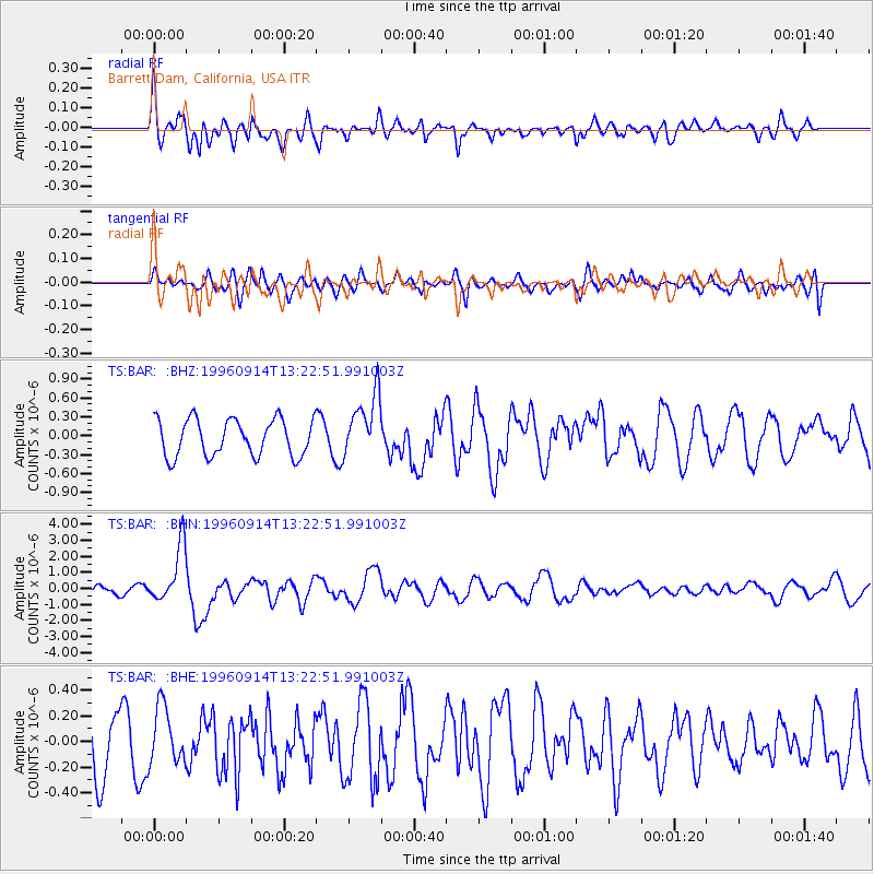
Signal To Noise
| Channel | StoN | STA | LTA |
| TS:BAR: :BHN:19960914T13:22:51.991003Z | 7.852599 | 1.783057E-6 | 2.2706584E-7 |
| TS:BAR: :BHE:19960914T13:22:51.991003Z | 0.80982405 | 2.2230002E-7 | 2.745041E-7 |
| TS:BAR: :BHZ:19960914T13:22:51.991003Z | 1.7324065 | 5.049335E-7 | 2.9146364E-7 |
| Arrivals |
| Ps | |
| PpPs | |
| PsPs/PpSs | |


