You are here: Home > Network List > TA - USArray Transportable Network (new EarthScope stations) Stations List
> Station L44A Lake County Forest Preserve, Grayslake, IL, USA > Earthquake Result Viewer
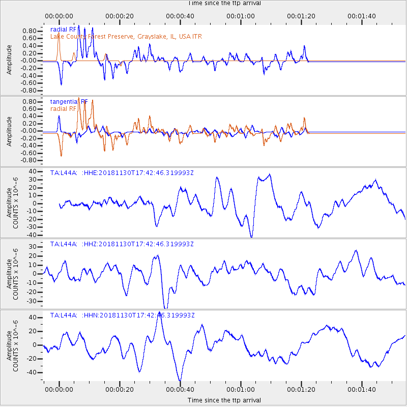
L44A Lake County Forest Preserve, Grayslake, IL, USA - Earthquake Result Viewer
*The percent match for this event was below the threshold and hence no stack was calculated.
| Earthquake location: |
Southern Alaska |
| Earthquake latitude/longitude: |
61.2/-149.9 |
| Earthquake time(UTC): |
2018/11/30 (334) 17:35:37 GMT |
| Earthquake Depth: |
39 km |
| Earthquake Magnitude: |
5.8 Ml |
| Earthquake Catalog/Contributor: |
NEIC PDE/ak |
|
| Network: |
TA USArray Transportable Network (new EarthScope stations) |
| Station: |
L44A Lake County Forest Preserve, Grayslake, IL, USA |
| Lat/Lon: |
42.18 N/87.91 W |
| Elevation: |
202 m |
|
| Distance: |
41.0 deg |
| Az: |
88.388 deg |
| Baz: |
319.34 deg |
| Ray Param: |
$rayparam |
*The percent match for this event was below the threshold and hence was not used in the summary stack. |
|
| Radial Match: |
67.22646 % |
| Radial Bump: |
263 |
| Transverse Match: |
61.355446 % |
| Transverse Bump: |
364 |
| SOD ConfigId: |
13570011 |
| Insert Time: |
2019-05-01 23:30:07.037 +0000 |
| GWidth: |
2.5 |
| Max Bumps: |
400 |
| Tol: |
0.001 |
|
Signal To Noise
| Channel | StoN | STA | LTA |
| TA:L44A: :HHZ:20181130T17:42:46.319993Z | 2.014491 | 7.740332E-6 | 3.8423264E-6 |
| TA:L44A: :HHN:20181130T17:42:46.319993Z | 2.5048895 | 1.1541313E-5 | 4.607514E-6 |
| TA:L44A: :HHE:20181130T17:42:46.319993Z | 4.725771 | 1.4361073E-5 | 3.0388846E-6 |
| Arrivals |
| Ps | |
| PpPs | |
| PsPs/PpSs | |


