You are here: Home > Network List > US - United States National Seismic Network Stations List
> Station GLMI Grayling, Michigan, USA > Earthquake Result Viewer
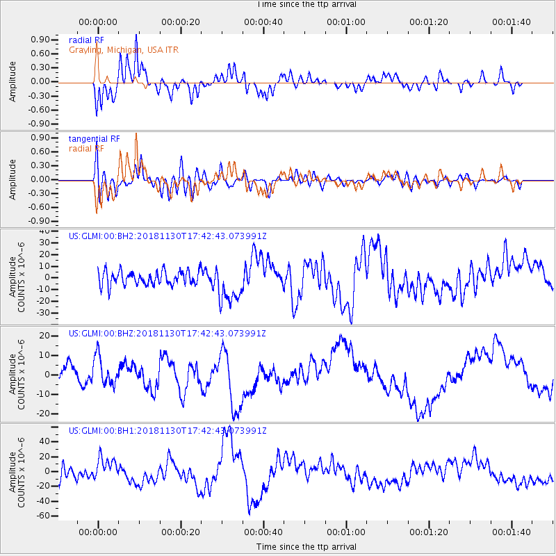
GLMI Grayling, Michigan, USA - Earthquake Result Viewer
*The percent match for this event was below the threshold and hence no stack was calculated.
| Earthquake location: |
Southern Alaska |
| Earthquake latitude/longitude: |
61.2/-149.9 |
| Earthquake time(UTC): |
2018/11/30 (334) 17:35:37 GMT |
| Earthquake Depth: |
39 km |
| Earthquake Magnitude: |
5.8 Ml |
| Earthquake Catalog/Contributor: |
NEIC PDE/ak |
|
| Network: |
US United States National Seismic Network |
| Station: |
GLMI Grayling, Michigan, USA |
| Lat/Lon: |
44.82 N/84.62 W |
| Elevation: |
387 m |
|
| Distance: |
40.6 deg |
| Az: |
82.959 deg |
| Baz: |
317.492 deg |
| Ray Param: |
$rayparam |
*The percent match for this event was below the threshold and hence was not used in the summary stack. |
|
| Radial Match: |
54.46338 % |
| Radial Bump: |
400 |
| Transverse Match: |
47.487244 % |
| Transverse Bump: |
400 |
| SOD ConfigId: |
13570011 |
| Insert Time: |
2019-05-01 23:30:38.546 +0000 |
| GWidth: |
2.5 |
| Max Bumps: |
400 |
| Tol: |
0.001 |
|
Signal To Noise
| Channel | StoN | STA | LTA |
| US:GLMI:00:BHZ:20181130T17:42:43.073991Z | 2.0667684 | 7.637685E-6 | 3.6954718E-6 |
| US:GLMI:00:BH1:20181130T17:42:43.073991Z | 1.5654613 | 1.5331902E-5 | 9.7938555E-6 |
| US:GLMI:00:BH2:20181130T17:42:43.073991Z | 2.8466332 | 1.714474E-5 | 6.0228135E-6 |
| Arrivals |
| Ps | |
| PpPs | |
| PsPs/PpSs | |


