You are here: Home > Network List > TA - USArray Transportable Network (new EarthScope stations) Stations List
> Station I21A Big Trails, Ten Sleep, WY, USA > Earthquake Result Viewer
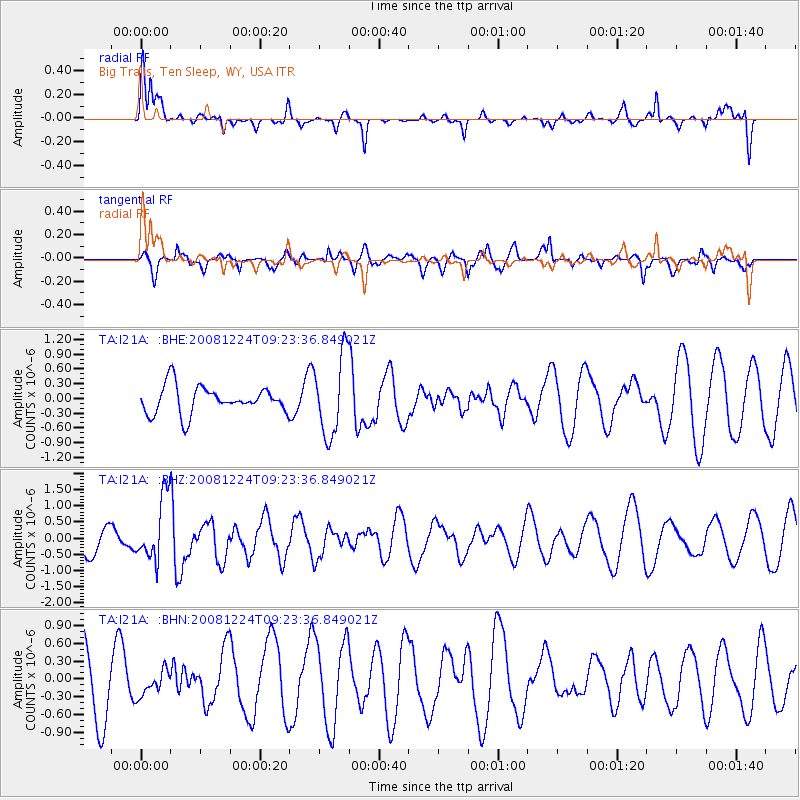
I21A Big Trails, Ten Sleep, WY, USA - Earthquake Result Viewer
*The percent match for this event was below the threshold and hence no stack was calculated.
| Earthquake location: |
Tonga Islands Region |
| Earthquake latitude/longitude: |
-17.3/-171.9 |
| Earthquake time(UTC): |
2008/12/24 (359) 09:11:34 GMT |
| Earthquake Depth: |
9.0 km |
| Earthquake Magnitude: |
5.9 MB, 5.6 MS, 6.0 MW, 6.0 MW |
| Earthquake Catalog/Contributor: |
WHDF/NEIC |
|
| Network: |
TA USArray Transportable Network (new EarthScope stations) |
| Station: |
I21A Big Trails, Ten Sleep, WY, USA |
| Lat/Lon: |
43.81 N/107.29 W |
| Elevation: |
1639 m |
|
| Distance: |
84.7 deg |
| Az: |
41.062 deg |
| Baz: |
240.098 deg |
| Ray Param: |
$rayparam |
*The percent match for this event was below the threshold and hence was not used in the summary stack. |
|
| Radial Match: |
78.70115 % |
| Radial Bump: |
400 |
| Transverse Match: |
60.783607 % |
| Transverse Bump: |
400 |
| SOD ConfigId: |
2658 |
| Insert Time: |
2010-03-06 18:26:04.259 +0000 |
| GWidth: |
2.5 |
| Max Bumps: |
400 |
| Tol: |
0.001 |
|
Signal To Noise
| Channel | StoN | STA | LTA |
| TA:I21A: :BHZ:20081224T09:23:36.849021Z | 1.3361502 | 9.776853E-7 | 7.3171816E-7 |
| TA:I21A: :BHN:20081224T09:23:36.849021Z | 0.27216947 | 2.0281867E-7 | 7.4519255E-7 |
| TA:I21A: :BHE:20081224T09:23:36.849021Z | 2.9237812 | 8.141187E-7 | 2.784472E-7 |
| Arrivals |
| Ps | |
| PpPs | |
| PsPs/PpSs | |


