You are here: Home > Network List > TA - USArray Transportable Network (new EarthScope stations) Stations List
> Station B18K Kokolik River, AK, USA > Earthquake Result Viewer
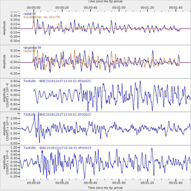
B18K Kokolik River, AK, USA - Earthquake Result Viewer
*The percent match for this event was below the threshold and hence no stack was calculated.
| Earthquake location: |
Banda Sea |
| Earthquake latitude/longitude: |
-7.4/128.7 |
| Earthquake time(UTC): |
2018/12/01 (335) 13:27:21 GMT |
| Earthquake Depth: |
141 km |
| Earthquake Magnitude: |
6.3 Mww |
| Earthquake Catalog/Contributor: |
NEIC PDE/us |
|
| Network: |
TA USArray Transportable Network (new EarthScope stations) |
| Station: |
B18K Kokolik River, AK, USA |
| Lat/Lon: |
69.36 N/161.80 W |
| Elevation: |
222 m |
|
| Distance: |
89.8 deg |
| Az: |
19.392 deg |
| Baz: |
248.265 deg |
| Ray Param: |
$rayparam |
*The percent match for this event was below the threshold and hence was not used in the summary stack. |
|
| Radial Match: |
65.69857 % |
| Radial Bump: |
400 |
| Transverse Match: |
63.378586 % |
| Transverse Bump: |
400 |
| SOD ConfigId: |
13570011 |
| Insert Time: |
2019-05-01 23:38:33.768 +0000 |
| GWidth: |
2.5 |
| Max Bumps: |
400 |
| Tol: |
0.001 |
|
Signal To Noise
| Channel | StoN | STA | LTA |
| TA:B18K: :BHZ:20181201T13:39:32.950002Z | 4.3554306 | 1.5723015E-6 | 3.6099794E-7 |
| TA:B18K: :BHN:20181201T13:39:32.950002Z | 1.1415392 | 3.16729E-7 | 2.7745784E-7 |
| TA:B18K: :BHE:20181201T13:39:32.950002Z | 1.636385 | 3.4517566E-7 | 2.1093793E-7 |
| Arrivals |
| Ps | |
| PpPs | |
| PsPs/PpSs | |


