You are here: Home > Network List > TA - USArray Transportable Network (new EarthScope stations) Stations List
> Station D25K Kavik River, AK, USA > Earthquake Result Viewer
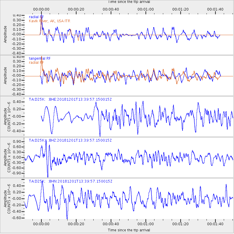
D25K Kavik River, AK, USA - Earthquake Result Viewer
*The percent match for this event was below the threshold and hence no stack was calculated.
| Earthquake location: |
Banda Sea |
| Earthquake latitude/longitude: |
-7.4/128.7 |
| Earthquake time(UTC): |
2018/12/01 (335) 13:27:21 GMT |
| Earthquake Depth: |
141 km |
| Earthquake Magnitude: |
6.3 Mww |
| Earthquake Catalog/Contributor: |
NEIC PDE/us |
|
| Network: |
TA USArray Transportable Network (new EarthScope stations) |
| Station: |
D25K Kavik River, AK, USA |
| Lat/Lon: |
69.32 N/146.38 W |
| Elevation: |
770 m |
|
| Distance: |
95.1 deg |
| Az: |
20.805 deg |
| Baz: |
262.638 deg |
| Ray Param: |
$rayparam |
*The percent match for this event was below the threshold and hence was not used in the summary stack. |
|
| Radial Match: |
71.978745 % |
| Radial Bump: |
400 |
| Transverse Match: |
48.620346 % |
| Transverse Bump: |
400 |
| SOD ConfigId: |
13570011 |
| Insert Time: |
2019-05-01 23:38:48.752 +0000 |
| GWidth: |
2.5 |
| Max Bumps: |
400 |
| Tol: |
0.001 |
|
Signal To Noise
| Channel | StoN | STA | LTA |
| TA:D25K: :BHZ:20181201T13:39:57.150015Z | 3.7412696 | 5.4493427E-7 | 1.4565491E-7 |
| TA:D25K: :BHN:20181201T13:39:57.150015Z | 2.0528162 | 2.6144716E-7 | 1.2736024E-7 |
| TA:D25K: :BHE:20181201T13:39:57.150015Z | 1.6866305 | 2.536386E-7 | 1.5038184E-7 |
| Arrivals |
| Ps | |
| PpPs | |
| PsPs/PpSs | |


