You are here: Home > Network List > TA - USArray Transportable Network (new EarthScope stations) Stations List
> Station F20K Avaraart Lake, AK, USA > Earthquake Result Viewer
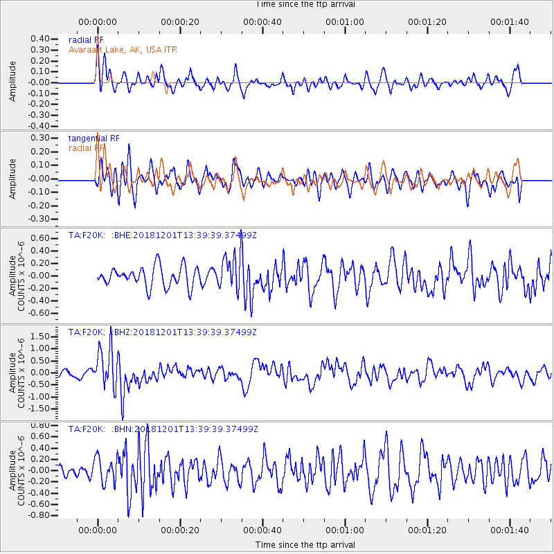
F20K Avaraart Lake, AK, USA - Earthquake Result Viewer
*The percent match for this event was below the threshold and hence no stack was calculated.
| Earthquake location: |
Banda Sea |
| Earthquake latitude/longitude: |
-7.4/128.7 |
| Earthquake time(UTC): |
2018/12/01 (335) 13:27:21 GMT |
| Earthquake Depth: |
141 km |
| Earthquake Magnitude: |
6.3 Mww |
| Earthquake Catalog/Contributor: |
NEIC PDE/us |
|
| Network: |
TA USArray Transportable Network (new EarthScope stations) |
| Station: |
F20K Avaraart Lake, AK, USA |
| Lat/Lon: |
67.05 N/155.73 W |
| Elevation: |
136 m |
|
| Distance: |
91.2 deg |
| Az: |
22.326 deg |
| Baz: |
253.878 deg |
| Ray Param: |
$rayparam |
*The percent match for this event was below the threshold and hence was not used in the summary stack. |
|
| Radial Match: |
64.98812 % |
| Radial Bump: |
375 |
| Transverse Match: |
51.379173 % |
| Transverse Bump: |
391 |
| SOD ConfigId: |
13570011 |
| Insert Time: |
2019-05-01 23:39:03.349 +0000 |
| GWidth: |
2.5 |
| Max Bumps: |
400 |
| Tol: |
0.001 |
|
Signal To Noise
| Channel | StoN | STA | LTA |
| TA:F20K: :BHZ:20181201T13:39:39.37499Z | 5.307809 | 8.463116E-7 | 1.594465E-7 |
| TA:F20K: :BHN:20181201T13:39:39.37499Z | 1.1169989 | 2.3191225E-7 | 2.0762083E-7 |
| TA:F20K: :BHE:20181201T13:39:39.37499Z | 1.8037804 | 2.832715E-7 | 1.5704323E-7 |
| Arrivals |
| Ps | |
| PpPs | |
| PsPs/PpSs | |


