You are here: Home > Network List > TS - TERRAscope (Southern California Seismic Network) Stations List
> Station BAR Barrett Dam, California, USA > Earthquake Result Viewer
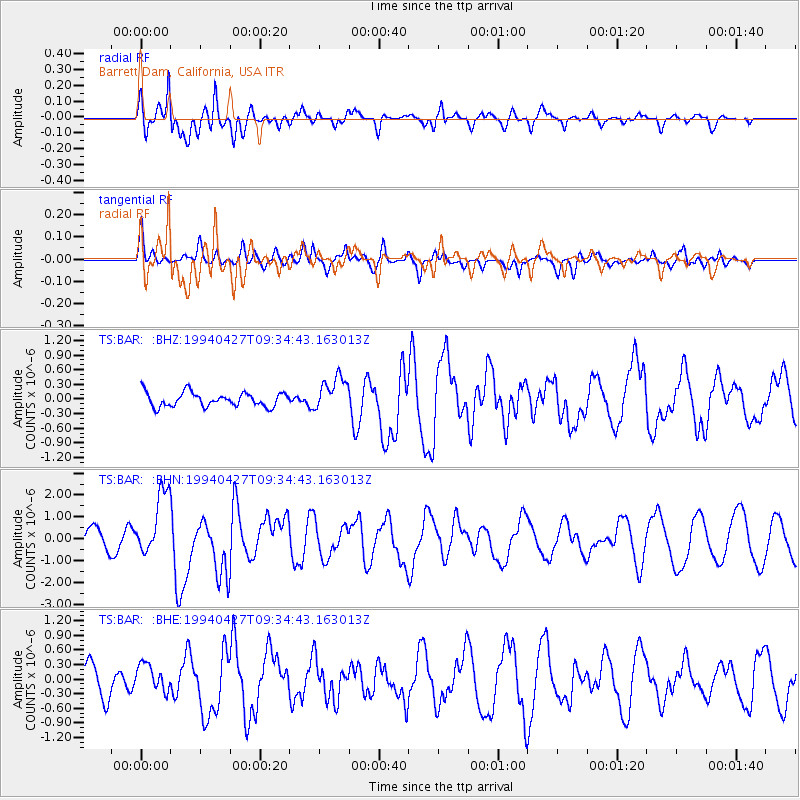
BAR Barrett Dam, California, USA - Earthquake Result Viewer
*The percent match for this event was below the threshold and hence no stack was calculated.
| Earthquake location: |
Tonga Islands |
| Earthquake latitude/longitude: |
-21.5/-173.7 |
| Earthquake time(UTC): |
1994/04/27 (117) 09:23:27 GMT |
| Earthquake Depth: |
35 km |
| Earthquake Magnitude: |
6.2 MB, 6.1 MS, 6.0 UNKNOWN, 6.4 MW |
| Earthquake Catalog/Contributor: |
WHDF/NEIC |
|
| Network: |
TS TERRAscope (Southern California Seismic Network) |
| Station: |
BAR Barrett Dam, California, USA |
| Lat/Lon: |
32.68 N/116.67 W |
| Elevation: |
548 m |
|
| Distance: |
76.6 deg |
| Az: |
46.667 deg |
| Baz: |
233.449 deg |
| Ray Param: |
$rayparam |
*The percent match for this event was below the threshold and hence was not used in the summary stack. |
|
| Radial Match: |
79.95382 % |
| Radial Bump: |
385 |
| Transverse Match: |
58.160023 % |
| Transverse Bump: |
400 |
| SOD ConfigId: |
4480 |
| Insert Time: |
2010-02-26 14:01:29.921 +0000 |
| GWidth: |
2.5 |
| Max Bumps: |
400 |
| Tol: |
0.001 |
|
Signal To Noise
| Channel | StoN | STA | LTA |
| TS:BAR: :BHN:19940427T09:34:43.163013Z | 3.258276 | 1.4707337E-6 | 4.5138398E-7 |
| TS:BAR: :BHE:19940427T09:34:43.163013Z | 0.9223798 | 2.86817E-7 | 3.1095325E-7 |
| TS:BAR: :BHZ:19940427T09:34:43.163013Z | 2.4113667 | 3.4968653E-7 | 1.450159E-7 |
| Arrivals |
| Ps | |
| PpPs | |
| PsPs/PpSs | |


