You are here: Home > Network List > US - United States National Seismic Network Stations List
> Station AMTX Amarillo, Texas, USA > Earthquake Result Viewer
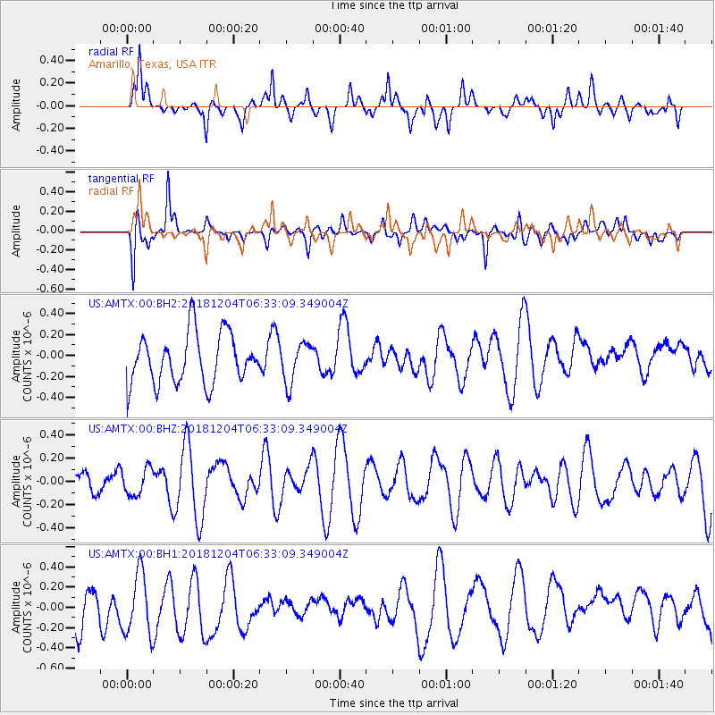
AMTX Amarillo, Texas, USA - Earthquake Result Viewer
*The percent match for this event was below the threshold and hence no stack was calculated.
| Earthquake location: |
Southern East Pacific Rise |
| Earthquake latitude/longitude: |
-56.2/-124.1 |
| Earthquake time(UTC): |
2018/12/04 (338) 06:20:28 GMT |
| Earthquake Depth: |
10 km |
| Earthquake Magnitude: |
5.5 Mwb |
| Earthquake Catalog/Contributor: |
NEIC PDE/us |
|
| Network: |
US United States National Seismic Network |
| Station: |
AMTX Amarillo, Texas, USA |
| Lat/Lon: |
34.53 N/101.41 W |
| Elevation: |
1010 m |
|
| Distance: |
92.5 deg |
| Az: |
18.622 deg |
| Baz: |
192.474 deg |
| Ray Param: |
$rayparam |
*The percent match for this event was below the threshold and hence was not used in the summary stack. |
|
| Radial Match: |
54.244255 % |
| Radial Bump: |
400 |
| Transverse Match: |
43.402847 % |
| Transverse Bump: |
400 |
| SOD ConfigId: |
13570011 |
| Insert Time: |
2019-05-01 23:56:30.313 +0000 |
| GWidth: |
2.5 |
| Max Bumps: |
400 |
| Tol: |
0.001 |
|
Signal To Noise
| Channel | StoN | STA | LTA |
| US:AMTX:00:BHZ:20181204T06:33:09.349004Z | 0.5968275 | 1.1535271E-7 | 1.9327648E-7 |
| US:AMTX:00:BH1:20181204T06:33:09.349004Z | 1.7007884 | 3.162961E-7 | 1.859703E-7 |
| US:AMTX:00:BH2:20181204T06:33:09.349004Z | 0.91813475 | 2.2356605E-7 | 2.4350027E-7 |
| Arrivals |
| Ps | |
| PpPs | |
| PsPs/PpSs | |


