You are here: Home > Network List > TS - TERRAscope (Southern California Seismic Network) Stations List
> Station BAR Barrett Dam, California, USA > Earthquake Result Viewer
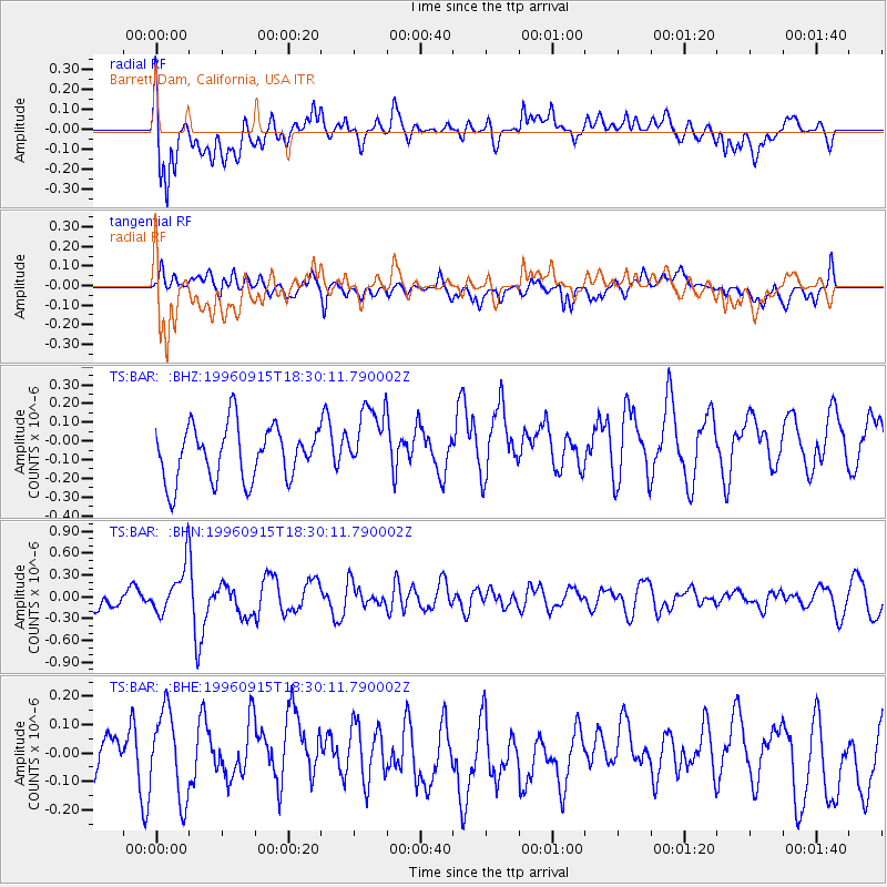
BAR Barrett Dam, California, USA - Earthquake Result Viewer
*The percent match for this event was below the threshold and hence no stack was calculated.
| Earthquake location: |
Solomon Islands |
| Earthquake latitude/longitude: |
-6.5/154.8 |
| Earthquake time(UTC): |
1996/09/15 (259) 18:17:38 GMT |
| Earthquake Depth: |
50 km |
| Earthquake Magnitude: |
5.7 MB, 5.8 MS, 5.9 UNKNOWN, 5.9 MW |
| Earthquake Catalog/Contributor: |
WHDF/NEIC |
|
| Network: |
TS TERRAscope (Southern California Seismic Network) |
| Station: |
BAR Barrett Dam, California, USA |
| Lat/Lon: |
32.68 N/116.67 W |
| Elevation: |
548 m |
|
| Distance: |
92.2 deg |
| Az: |
57.533 deg |
| Baz: |
263.774 deg |
| Ray Param: |
$rayparam |
*The percent match for this event was below the threshold and hence was not used in the summary stack. |
|
| Radial Match: |
73.698135 % |
| Radial Bump: |
400 |
| Transverse Match: |
56.882053 % |
| Transverse Bump: |
400 |
| SOD ConfigId: |
4480 |
| Insert Time: |
2010-02-26 14:01:30.811 +0000 |
| GWidth: |
2.5 |
| Max Bumps: |
400 |
| Tol: |
0.001 |
|
Signal To Noise
| Channel | StoN | STA | LTA |
| TS:BAR: :BHN:19960915T18:30:11.790002Z | 1.2721977 | 3.4158097E-7 | 2.684968E-7 |
| TS:BAR: :BHE:19960915T18:30:11.790002Z | 1.9352216 | 1.5565475E-7 | 8.043252E-8 |
| TS:BAR: :BHZ:19960915T18:30:11.790002Z | 1.2945392 | 1.8649074E-7 | 1.4405956E-7 |
| Arrivals |
| Ps | |
| PpPs | |
| PsPs/PpSs | |


