You are here: Home > Network List > CN - Canadian National Seismograph Network Stations List
> Station INK INUVIK, NT > Earthquake Result Viewer
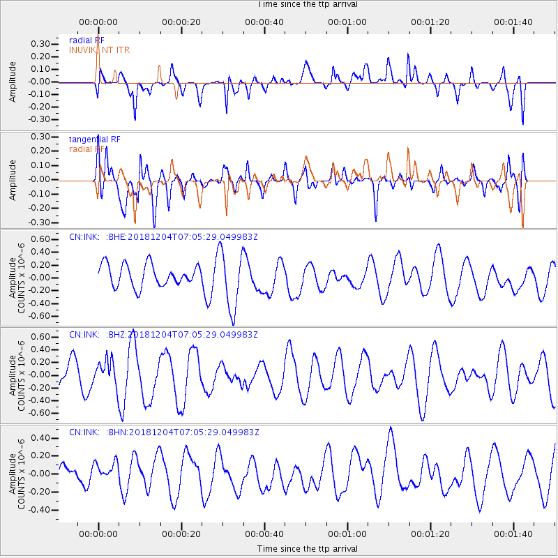
INK INUVIK, NT - Earthquake Result Viewer
*The percent match for this event was below the threshold and hence no stack was calculated.
| Earthquake location: |
Northern Molucca Sea |
| Earthquake latitude/longitude: |
2.3/126.8 |
| Earthquake time(UTC): |
2018/12/04 (338) 06:52:59 GMT |
| Earthquake Depth: |
51 km |
| Earthquake Magnitude: |
5.4 Mww |
| Earthquake Catalog/Contributor: |
NEIC PDE/us |
|
| Network: |
CN Canadian National Seismograph Network |
| Station: |
INK INUVIK, NT |
| Lat/Lon: |
68.31 N/133.53 W |
| Elevation: |
44 m |
|
| Distance: |
91.4 deg |
| Az: |
21.509 deg |
| Baz: |
279.805 deg |
| Ray Param: |
$rayparam |
*The percent match for this event was below the threshold and hence was not used in the summary stack. |
|
| Radial Match: |
57.509605 % |
| Radial Bump: |
400 |
| Transverse Match: |
71.58802 % |
| Transverse Bump: |
400 |
| SOD ConfigId: |
13570011 |
| Insert Time: |
2019-05-01 23:58:37.704 +0000 |
| GWidth: |
2.5 |
| Max Bumps: |
400 |
| Tol: |
0.001 |
|
Signal To Noise
| Channel | StoN | STA | LTA |
| CN:INK: :BHZ:20181204T07:05:29.049983Z | 0.9060127 | 2.0204813E-7 | 2.2300803E-7 |
| CN:INK: :BHN:20181204T07:05:29.049983Z | 0.7397967 | 1.07025265E-7 | 1.4466848E-7 |
| CN:INK: :BHE:20181204T07:05:29.049983Z | 2.797195 | 4.682771E-7 | 1.6740952E-7 |
| Arrivals |
| Ps | |
| PpPs | |
| PsPs/PpSs | |


