You are here: Home > Network List > CI - Caltech Regional Seismic Network Stations List
> Station DGR Domenigoni Reservoir, California, USA > Earthquake Result Viewer
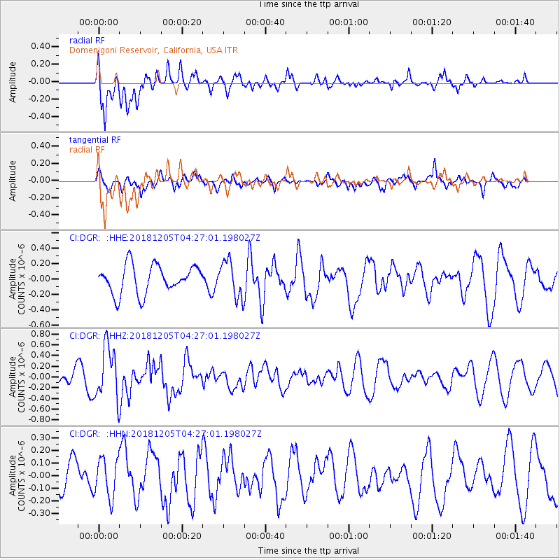
DGR Domenigoni Reservoir, California, USA - Earthquake Result Viewer
*The percent match for this event was below the threshold and hence no stack was calculated.
| Earthquake location: |
Southeast Of Loyalty Islands |
| Earthquake latitude/longitude: |
-22.0/169.3 |
| Earthquake time(UTC): |
2018/12/05 (339) 04:14:36 GMT |
| Earthquake Depth: |
10 km |
| Earthquake Magnitude: |
6.0 mb |
| Earthquake Catalog/Contributor: |
NEIC PDE/us |
|
| Network: |
CI Caltech Regional Seismic Network |
| Station: |
DGR Domenigoni Reservoir, California, USA |
| Lat/Lon: |
33.65 N/117.01 W |
| Elevation: |
609 m |
|
| Distance: |
89.3 deg |
| Az: |
53.185 deg |
| Baz: |
242.976 deg |
| Ray Param: |
$rayparam |
*The percent match for this event was below the threshold and hence was not used in the summary stack. |
|
| Radial Match: |
65.79168 % |
| Radial Bump: |
400 |
| Transverse Match: |
65.27291 % |
| Transverse Bump: |
400 |
| SOD ConfigId: |
13570011 |
| Insert Time: |
2019-05-02 00:03:26.636 +0000 |
| GWidth: |
2.5 |
| Max Bumps: |
400 |
| Tol: |
0.001 |
|
Signal To Noise
| Channel | StoN | STA | LTA |
| CI:DGR: :HHZ:20181205T04:27:01.198027Z | 4.270408 | 4.983245E-7 | 1.1669247E-7 |
| CI:DGR: :HHN:20181205T04:27:01.198027Z | 1.0511589 | 1.5725948E-7 | 1.4960581E-7 |
| CI:DGR: :HHE:20181205T04:27:01.198027Z | 1.3359284 | 2.462552E-7 | 1.8433265E-7 |
| Arrivals |
| Ps | |
| PpPs | |
| PsPs/PpSs | |


