You are here: Home > Network List > CI - Caltech Regional Seismic Network Stations List
> Station MPM Manuel Prospect Mine, California, USA > Earthquake Result Viewer
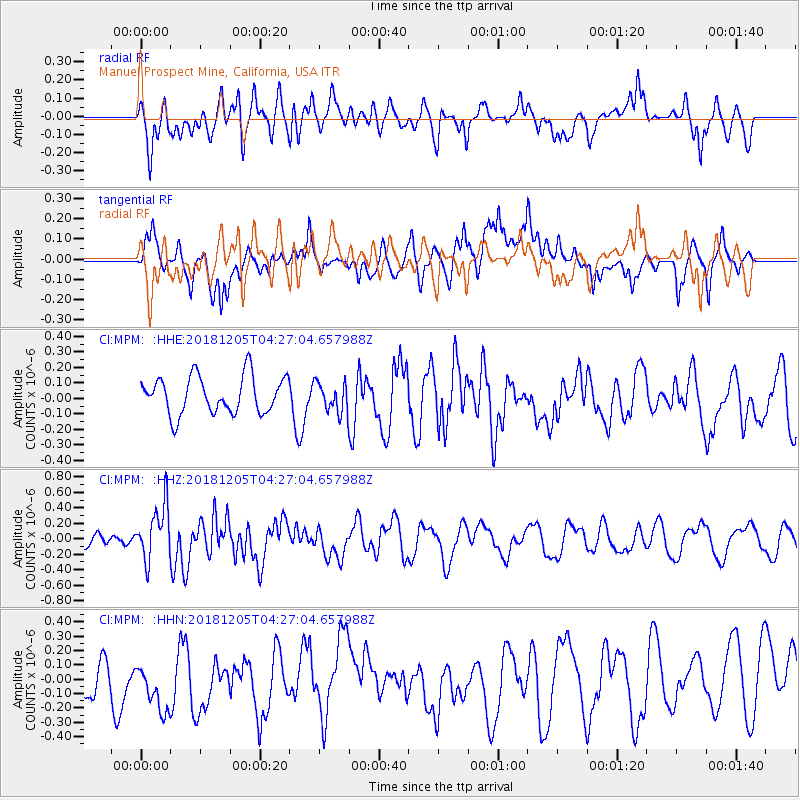
MPM Manuel Prospect Mine, California, USA - Earthquake Result Viewer
*The percent match for this event was below the threshold and hence no stack was calculated.
| Earthquake location: |
Southeast Of Loyalty Islands |
| Earthquake latitude/longitude: |
-22.0/169.3 |
| Earthquake time(UTC): |
2018/12/05 (339) 04:14:36 GMT |
| Earthquake Depth: |
10 km |
| Earthquake Magnitude: |
6.0 mb |
| Earthquake Catalog/Contributor: |
NEIC PDE/us |
|
| Network: |
CI Caltech Regional Seismic Network |
| Station: |
MPM Manuel Prospect Mine, California, USA |
| Lat/Lon: |
36.06 N/117.49 W |
| Elevation: |
185 m |
|
| Distance: |
90.0 deg |
| Az: |
50.868 deg |
| Baz: |
242.69 deg |
| Ray Param: |
$rayparam |
*The percent match for this event was below the threshold and hence was not used in the summary stack. |
|
| Radial Match: |
53.087597 % |
| Radial Bump: |
400 |
| Transverse Match: |
48.64779 % |
| Transverse Bump: |
400 |
| SOD ConfigId: |
13570011 |
| Insert Time: |
2019-05-02 00:03:37.716 +0000 |
| GWidth: |
2.5 |
| Max Bumps: |
400 |
| Tol: |
0.001 |
|
Signal To Noise
| Channel | StoN | STA | LTA |
| CI:MPM: :HHZ:20181205T04:27:04.657988Z | 3.043057 | 3.4898687E-7 | 1.1468299E-7 |
| CI:MPM: :HHN:20181205T04:27:04.657988Z | 1.7722898 | 2.3304403E-7 | 1.314932E-7 |
| CI:MPM: :HHE:20181205T04:27:04.657988Z | 0.79515773 | 9.571415E-8 | 1.2037127E-7 |
| Arrivals |
| Ps | |
| PpPs | |
| PsPs/PpSs | |


