You are here: Home > Network List > TS - TERRAscope (Southern California Seismic Network) Stations List
> Station BAR Barrett Dam, California, USA > Earthquake Result Viewer
BAR Barrett Dam, California, USA - Earthquake Result Viewer
*The percent match for this event was below the threshold and hence no stack was calculated.
| Earthquake location: |
Santiago Del Estero Prov., Arg. |
| Earthquake latitude/longitude: |
-28.3/-63.2 |
| Earthquake time(UTC): |
1994/04/29 (119) 07:11:30 GMT |
| Earthquake Depth: |
573 km |
| Earthquake Magnitude: |
6.4 MB, 6.0 UNKNOWN, 6.9 MW |
| Earthquake Catalog/Contributor: |
WHDF/NEIC |
|
| Network: |
TS TERRAscope (Southern California Seismic Network) |
| Station: |
BAR Barrett Dam, California, USA |
| Lat/Lon: |
32.68 N/116.67 W |
| Elevation: |
548 m |
|
| Distance: |
79.1 deg |
| Az: |
316.342 deg |
| Baz: |
133.795 deg |
| Ray Param: |
$rayparam |
*The percent match for this event was below the threshold and hence was not used in the summary stack. |
|
| Radial Match: |
60.342194 % |
| Radial Bump: |
400 |
| Transverse Match: |
71.398415 % |
| Transverse Bump: |
400 |
| SOD ConfigId: |
4480 |
| Insert Time: |
2010-02-26 14:01:31.352 +0000 |
| GWidth: |
2.5 |
| Max Bumps: |
400 |
| Tol: |
0.001 |
|
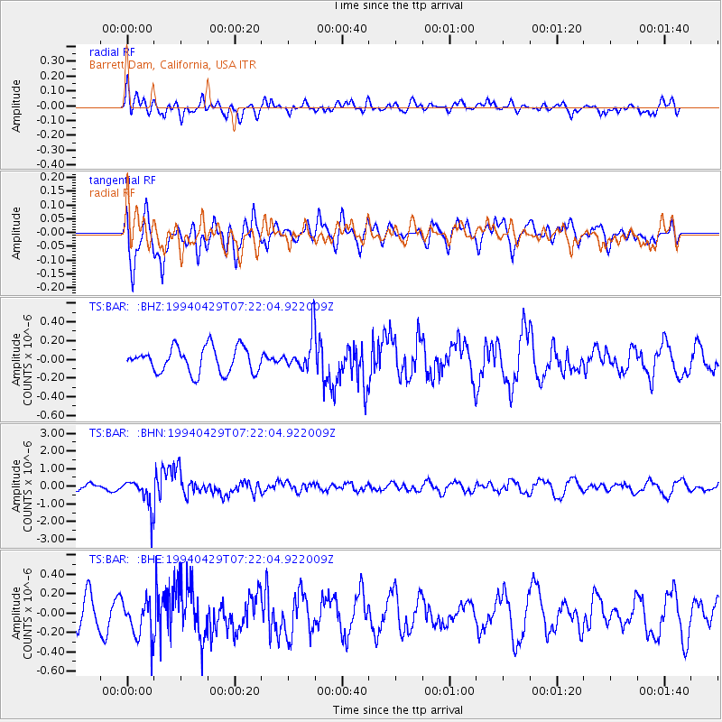
Signal To Noise
| Channel | StoN | STA | LTA |
| TS:BAR: :BHN:19940429T07:22:04.922009Z | 5.4759994 | 8.6381937E-7 | 1.5774643E-7 |
| TS:BAR: :BHE:19940429T07:22:04.922009Z | 1.6237826 | 2.0223825E-7 | 1.2454761E-7 |
| TS:BAR: :BHZ:19940429T07:22:04.922009Z | 1.4623152 | 1.9643997E-7 | 1.343349E-7 |
| Arrivals |
| Ps | |
| PpPs | |
| PsPs/PpSs | |


