You are here: Home > Network List > TA - USArray Transportable Network (new EarthScope stations) Stations List
> Station P13A Bates Ranch, Gandy, UT, USA > Earthquake Result Viewer
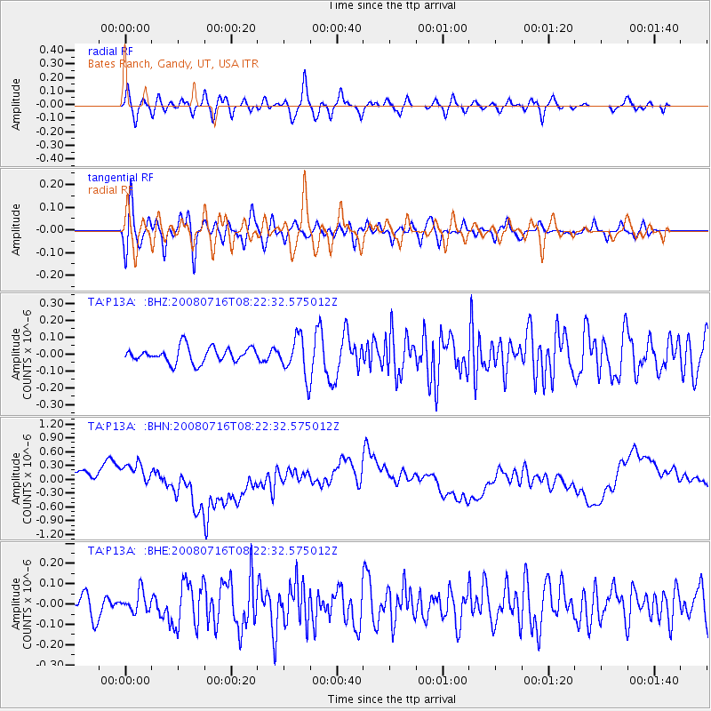
P13A Bates Ranch, Gandy, UT, USA - Earthquake Result Viewer
*The percent match for this event was below the threshold and hence no stack was calculated.
| Earthquake location: |
Samoa Islands Region |
| Earthquake latitude/longitude: |
-16.6/-173.0 |
| Earthquake time(UTC): |
2008/07/16 (198) 08:11:04 GMT |
| Earthquake Depth: |
10 km |
| Earthquake Magnitude: |
5.5 MB, 5.4 MS, 5.7 MW, 5.7 MW |
| Earthquake Catalog/Contributor: |
WHDF/NEIC |
|
| Network: |
TA USArray Transportable Network (new EarthScope stations) |
| Station: |
P13A Bates Ranch, Gandy, UT, USA |
| Lat/Lon: |
39.46 N/114.02 W |
| Elevation: |
1555 m |
|
| Distance: |
78.3 deg |
| Az: |
42.641 deg |
| Baz: |
237.029 deg |
| Ray Param: |
$rayparam |
*The percent match for this event was below the threshold and hence was not used in the summary stack. |
|
| Radial Match: |
61.00342 % |
| Radial Bump: |
400 |
| Transverse Match: |
68.33262 % |
| Transverse Bump: |
400 |
| SOD ConfigId: |
2504 |
| Insert Time: |
2010-03-06 18:28:45.005 +0000 |
| GWidth: |
2.5 |
| Max Bumps: |
400 |
| Tol: |
0.001 |
|
Signal To Noise
| Channel | StoN | STA | LTA |
| TA:P13A: :BHN:20080716T08:22:32.575012Z | 2.1900737 | 2.3668001E-7 | 1.0806943E-7 |
| TA:P13A: :BHE:20080716T08:22:32.575012Z | 1.054421 | 5.0565646E-8 | 4.7955844E-8 |
| TA:P13A: :BHZ:20080716T08:22:32.575012Z | 2.595577 | 1.1681342E-7 | 4.50048E-8 |
| Arrivals |
| Ps | |
| PpPs | |
| PsPs/PpSs | |


