You are here: Home > Network List > CI - Caltech Regional Seismic Network Stations List
> Station SNCC San Nicolas Island, , CA, USA > Earthquake Result Viewer
SNCC San Nicolas Island, , CA, USA - Earthquake Result Viewer

| Earthquake location: |
Southeast Of Loyalty Islands |
| Earthquake latitude/longitude: |
-22.0/169.4 |
| Earthquake time(UTC): |
2018/12/05 (339) 04:18:08 GMT |
| Earthquake Depth: |
10 km |
| Earthquake Magnitude: |
7.5 Mww |
| Earthquake Catalog/Contributor: |
NEIC PDE/us |
|
| Network: |
CI Caltech Regional Seismic Network |
| Station: |
SNCC San Nicolas Island, , CA, USA |
| Lat/Lon: |
33.25 N/119.52 W |
| Elevation: |
275 m |
|
| Distance: |
87.1 deg |
| Az: |
52.51 deg |
| Baz: |
241.514 deg |
| Ray Param: |
0.04353933 |
| Estimated Moho Depth: |
19.25 km |
| Estimated Crust Vp/Vs: |
1.60 |
| Assumed Crust Vp: |
6.048 km/s |
| Estimated Crust Vs: |
3.78 km/s |
| Estimated Crust Poisson's Ratio: |
0.18 |
|
| Radial Match: |
92.26322 % |
| Radial Bump: |
400 |
| Transverse Match: |
91.23531 % |
| Transverse Bump: |
400 |
| SOD ConfigId: |
13570011 |
| Insert Time: |
2019-05-02 00:12:33.985 +0000 |
| GWidth: |
2.5 |
| Max Bumps: |
400 |
| Tol: |
0.001 |
|
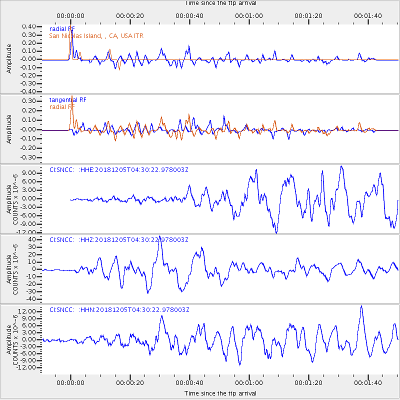
Signal To Noise
| Channel | StoN | STA | LTA |
| CI:SNCC: :HHZ:20181205T04:30:22.978003Z | 4.082417 | 2.0257346E-6 | 4.962097E-7 |
| CI:SNCC: :HHN:20181205T04:30:22.978003Z | 1.3808987 | 6.0638405E-7 | 4.3912277E-7 |
| CI:SNCC: :HHE:20181205T04:30:22.978003Z | 0.9788895 | 4.9969907E-7 | 5.1047545E-7 |
| Arrivals |
| Ps | 2.0 SECOND |
| PpPs | 8.1 SECOND |
| PsPs/PpSs | 10 SECOND |


