You are here: Home > Network List > TS - TERRAscope (Southern California Seismic Network) Stations List
> Station BAR Barrett Dam, California, USA > Earthquake Result Viewer
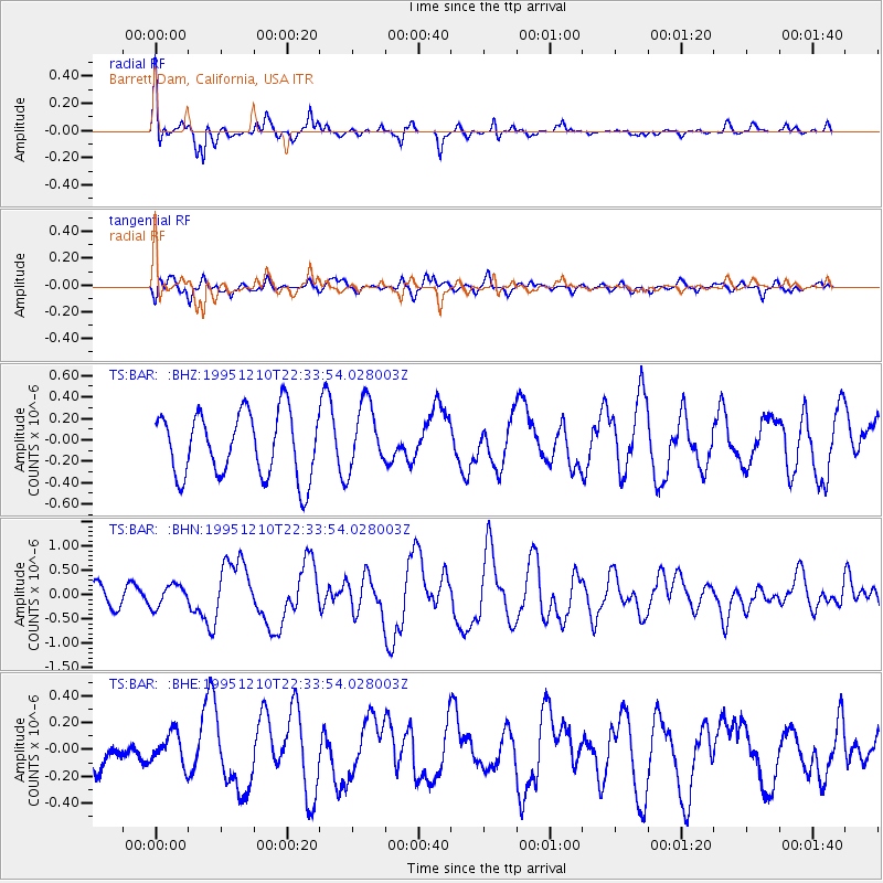
BAR Barrett Dam, California, USA - Earthquake Result Viewer
*The percent match for this event was below the threshold and hence no stack was calculated.
| Earthquake location: |
Kuril Islands |
| Earthquake latitude/longitude: |
44.3/149.8 |
| Earthquake time(UTC): |
1995/12/10 (344) 22:23:14 GMT |
| Earthquake Depth: |
33 km |
| Earthquake Magnitude: |
5.6 MB, 6.4 MS |
| Earthquake Catalog/Contributor: |
WHDF/NEIC |
|
| Network: |
TS TERRAscope (Southern California Seismic Network) |
| Station: |
BAR Barrett Dam, California, USA |
| Lat/Lon: |
32.68 N/116.67 W |
| Elevation: |
548 m |
|
| Distance: |
70.3 deg |
| Az: |
63.375 deg |
| Baz: |
310.471 deg |
| Ray Param: |
$rayparam |
*The percent match for this event was below the threshold and hence was not used in the summary stack. |
|
| Radial Match: |
73.3058 % |
| Radial Bump: |
352 |
| Transverse Match: |
53.745876 % |
| Transverse Bump: |
400 |
| SOD ConfigId: |
4480 |
| Insert Time: |
2010-02-26 14:01:33.293 +0000 |
| GWidth: |
2.5 |
| Max Bumps: |
400 |
| Tol: |
0.001 |
|
Signal To Noise
| Channel | StoN | STA | LTA |
| TS:BAR: :BHN:19951210T22:33:54.028003Z | 0.7374481 | 2.2750375E-7 | 3.0850137E-7 |
| TS:BAR: :BHE:19951210T22:33:54.028003Z | 0.888546 | 1.2141307E-7 | 1.3664241E-7 |
| TS:BAR: :BHZ:19951210T22:33:54.028003Z | 1.0451086 | 3.1480928E-7 | 3.012216E-7 |
| Arrivals |
| Ps | |
| PpPs | |
| PsPs/PpSs | |


