You are here: Home > Network List > TA - USArray Transportable Network (new EarthScope stations) Stations List
> Station E24A Baker, MT, USA > Earthquake Result Viewer
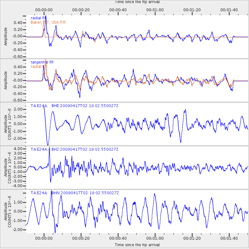
E24A Baker, MT, USA - Earthquake Result Viewer
*The percent match for this event was below the threshold and hence no stack was calculated.
| Earthquake location: |
Near Coast Of Northern Chile |
| Earthquake latitude/longitude: |
-19.6/-70.5 |
| Earthquake time(UTC): |
2009/04/17 (107) 02:08:08 GMT |
| Earthquake Depth: |
25 km |
| Earthquake Magnitude: |
5.8 MB, 5.8 MS, 6.1 MW, 6.1 MW |
| Earthquake Catalog/Contributor: |
WHDF/NEIC |
|
| Network: |
TA USArray Transportable Network (new EarthScope stations) |
| Station: |
E24A Baker, MT, USA |
| Lat/Lon: |
46.56 N/104.31 W |
| Elevation: |
912 m |
|
| Distance: |
72.6 deg |
| Az: |
336.262 deg |
| Baz: |
146.629 deg |
| Ray Param: |
$rayparam |
*The percent match for this event was below the threshold and hence was not used in the summary stack. |
|
| Radial Match: |
67.87941 % |
| Radial Bump: |
328 |
| Transverse Match: |
58.783875 % |
| Transverse Bump: |
400 |
| SOD ConfigId: |
2658 |
| Insert Time: |
2010-03-06 18:30:37.837 +0000 |
| GWidth: |
2.5 |
| Max Bumps: |
400 |
| Tol: |
0.001 |
|
Signal To Noise
| Channel | StoN | STA | LTA |
| TA:E24A: :BHZ:20090417T02:19:02.550027Z | 5.2268877 | 1.512536E-6 | 2.89376E-7 |
| TA:E24A: :BHN:20090417T02:19:02.550027Z | 1.2641714 | 9.1805026E-7 | 7.262071E-7 |
| TA:E24A: :BHE:20090417T02:19:02.550027Z | 0.42458218 | 4.265804E-7 | 1.0047063E-6 |
| Arrivals |
| Ps | |
| PpPs | |
| PsPs/PpSs | |


