You are here: Home > Network List > TA - USArray Transportable Network (new EarthScope stations) Stations List
> Station E24A Baker, MT, USA > Earthquake Result Viewer
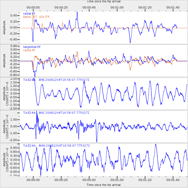
E24A Baker, MT, USA - Earthquake Result Viewer
*The percent match for this event was below the threshold and hence no stack was calculated.
| Earthquake location: |
Chile-Bolivia Border Region |
| Earthquake latitude/longitude: |
-21.4/-68.3 |
| Earthquake time(UTC): |
2008/12/04 (339) 16:47:09 GMT |
| Earthquake Depth: |
115 km |
| Earthquake Magnitude: |
5.5 MB, 5.5 MW, 5.5 MW |
| Earthquake Catalog/Contributor: |
WHDF/NEIC |
|
| Network: |
TA USArray Transportable Network (new EarthScope stations) |
| Station: |
E24A Baker, MT, USA |
| Lat/Lon: |
46.56 N/104.31 W |
| Elevation: |
912 m |
|
| Distance: |
75.1 deg |
| Az: |
335.168 deg |
| Baz: |
145.445 deg |
| Ray Param: |
$rayparam |
*The percent match for this event was below the threshold and hence was not used in the summary stack. |
|
| Radial Match: |
63.924088 % |
| Radial Bump: |
400 |
| Transverse Match: |
58.497967 % |
| Transverse Bump: |
397 |
| SOD ConfigId: |
2658 |
| Insert Time: |
2010-03-06 18:31:18.124 +0000 |
| GWidth: |
2.5 |
| Max Bumps: |
400 |
| Tol: |
0.001 |
|
Signal To Noise
| Channel | StoN | STA | LTA |
| TA:E24A: :BHZ:20081204T16:58:07.775027Z | 3.5383556 | 8.2446735E-7 | 2.3300862E-7 |
| TA:E24A: :BHN:20081204T16:58:07.775027Z | 1.1032057 | 5.2276755E-7 | 4.738623E-7 |
| TA:E24A: :BHE:20081204T16:58:07.775027Z | 1.2090318 | 9.139892E-7 | 7.5596785E-7 |
| Arrivals |
| Ps | |
| PpPs | |
| PsPs/PpSs | |


