You are here: Home > Network List > AV - Alaska Volcano Observatory Stations List
> Station SPCR Ckakachatna River, Mount Spurr, Alaska > Earthquake Result Viewer
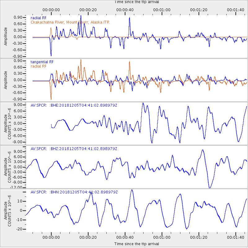
SPCR Ckakachatna River, Mount Spurr, Alaska - Earthquake Result Viewer
*The percent match for this event was below the threshold and hence no stack was calculated.
| Earthquake location: |
Southeast Of Loyalty Islands |
| Earthquake latitude/longitude: |
-21.5/169.4 |
| Earthquake time(UTC): |
2018/12/05 (339) 04:28:44 GMT |
| Earthquake Depth: |
10 km |
| Earthquake Magnitude: |
5.9 mb |
| Earthquake Catalog/Contributor: |
NEIC PDE/us |
|
| Network: |
AV Alaska Volcano Observatory |
| Station: |
SPCR Ckakachatna River, Mount Spurr, Alaska |
| Lat/Lon: |
61.20 N/152.21 W |
| Elevation: |
984 m |
|
| Distance: |
88.0 deg |
| Az: |
17.525 deg |
| Baz: |
215.382 deg |
| Ray Param: |
$rayparam |
*The percent match for this event was below the threshold and hence was not used in the summary stack. |
|
| Radial Match: |
57.346695 % |
| Radial Bump: |
400 |
| Transverse Match: |
48.89941 % |
| Transverse Bump: |
400 |
| SOD ConfigId: |
13570011 |
| Insert Time: |
2019-05-02 00:21:32.325 +0000 |
| GWidth: |
2.5 |
| Max Bumps: |
400 |
| Tol: |
0.001 |
|
Signal To Noise
| Channel | StoN | STA | LTA |
| AV:SPCR: :BHZ:20181205T04:41:02.898979Z | 0.82553655 | 2.2433671E-6 | 2.7174656E-6 |
| AV:SPCR: :BHN:20181205T04:41:02.898979Z | 1.7512381 | 4.5656693E-6 | 2.6071093E-6 |
| AV:SPCR: :BHE:20181205T04:41:02.898979Z | 1.4967778 | 2.3479813E-6 | 1.5686907E-6 |
| Arrivals |
| Ps | |
| PpPs | |
| PsPs/PpSs | |


