You are here: Home > Network List > IU - Global Seismograph Network (GSN - IRIS/USGS) Stations List
> Station FURI Mt. Furi, Ethiopia > Earthquake Result Viewer
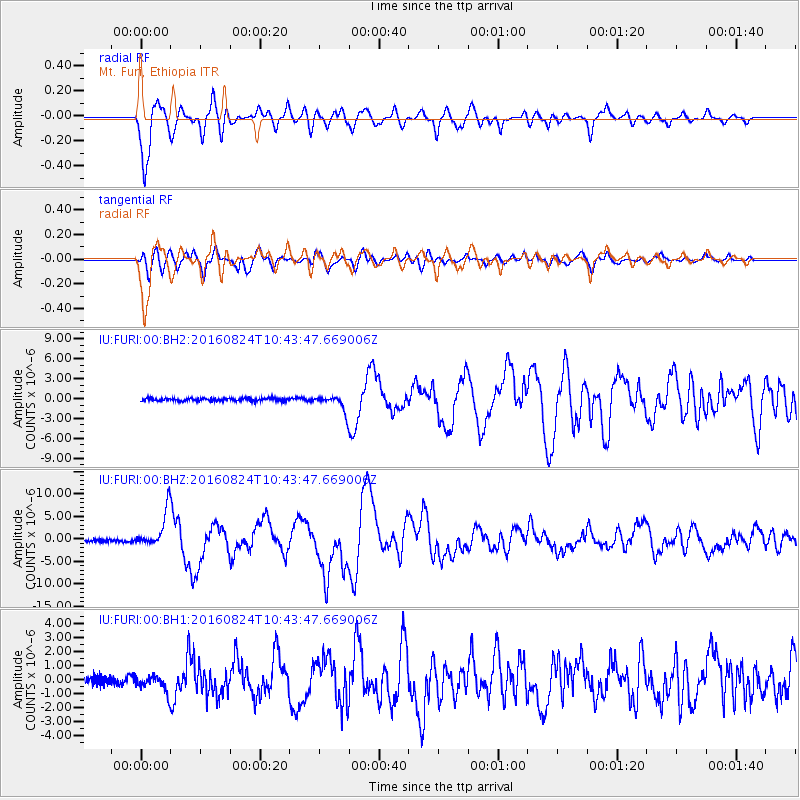
FURI Mt. Furi, Ethiopia - Earthquake Result Viewer
*The percent match for this event was below the threshold and hence no stack was calculated.
| Earthquake location: |
Myanmar |
| Earthquake latitude/longitude: |
20.9/94.6 |
| Earthquake time(UTC): |
2016/08/24 (237) 10:34:55 GMT |
| Earthquake Depth: |
84 km |
| Earthquake Magnitude: |
6.8 MO |
| Earthquake Catalog/Contributor: |
NEIC PDE/NEIC ALERT |
|
| Network: |
IU Global Seismograph Network (GSN - IRIS/USGS) |
| Station: |
FURI Mt. Furi, Ethiopia |
| Lat/Lon: |
8.90 N/38.68 E |
| Elevation: |
2570 m |
|
| Distance: |
55.1 deg |
| Az: |
266.291 deg |
| Baz: |
70.757 deg |
| Ray Param: |
$rayparam |
*The percent match for this event was below the threshold and hence was not used in the summary stack. |
|
| Radial Match: |
94.709984 % |
| Radial Bump: |
400 |
| Transverse Match: |
87.866455 % |
| Transverse Bump: |
400 |
| SOD ConfigId: |
1634031 |
| Insert Time: |
2016-09-07 10:37:02.296 +0000 |
| GWidth: |
2.5 |
| Max Bumps: |
400 |
| Tol: |
0.001 |
|
Signal To Noise
| Channel | StoN | STA | LTA |
| IU:FURI:00:BHZ:20160824T10:43:47.669006Z | 13.561045 | 4.0719874E-6 | 3.0027093E-7 |
| IU:FURI:00:BH1:20160824T10:43:47.669006Z | 2.0098474 | 6.1489015E-7 | 3.0593873E-7 |
| IU:FURI:00:BH2:20160824T10:43:47.669006Z | 5.711444 | 1.2450053E-6 | 2.1798432E-7 |
| Arrivals |
| Ps | |
| PpPs | |
| PsPs/PpSs | |


