You are here: Home > Network List > CI - Caltech Regional Seismic Network Stations List
> Station MPP McPhearson Peak > Earthquake Result Viewer
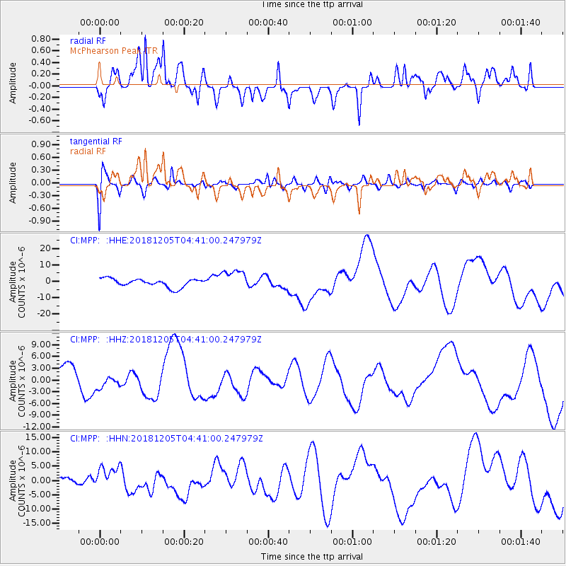
MPP McPhearson Peak - Earthquake Result Viewer
*The percent match for this event was below the threshold and hence no stack was calculated.
| Earthquake location: |
Southeast Of Loyalty Islands |
| Earthquake latitude/longitude: |
-21.5/169.4 |
| Earthquake time(UTC): |
2018/12/05 (339) 04:28:44 GMT |
| Earthquake Depth: |
10 km |
| Earthquake Magnitude: |
5.9 mb |
| Earthquake Catalog/Contributor: |
NEIC PDE/us |
|
| Network: |
CI Caltech Regional Seismic Network |
| Station: |
MPP McPhearson Peak |
| Lat/Lon: |
34.89 N/119.81 W |
| Elevation: |
1739 m |
|
| Distance: |
87.5 deg |
| Az: |
51.003 deg |
| Baz: |
241.682 deg |
| Ray Param: |
$rayparam |
*The percent match for this event was below the threshold and hence was not used in the summary stack. |
|
| Radial Match: |
58.48926 % |
| Radial Bump: |
400 |
| Transverse Match: |
57.02692 % |
| Transverse Bump: |
400 |
| SOD ConfigId: |
13570011 |
| Insert Time: |
2019-05-02 00:22:53.061 +0000 |
| GWidth: |
2.5 |
| Max Bumps: |
400 |
| Tol: |
0.001 |
|
Signal To Noise
| Channel | StoN | STA | LTA |
| CI:MPP: :HHZ:20181205T04:41:00.247979Z | 0.5246037 | 1.6079305E-6 | 3.065038E-6 |
| CI:MPP: :HHN:20181205T04:41:00.247979Z | 2.2684114 | 4.2873435E-6 | 1.8900201E-6 |
| CI:MPP: :HHE:20181205T04:41:00.247979Z | 2.5507386 | 6.3817984E-6 | 2.5019413E-6 |
| Arrivals |
| Ps | |
| PpPs | |
| PsPs/PpSs | |


