You are here: Home > Network List > CI - Caltech Regional Seismic Network Stations List
> Station SWS Sam W. Stewart, Westmorland, CA, USA > Earthquake Result Viewer
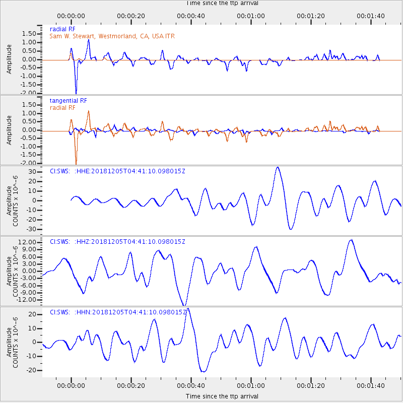
SWS Sam W. Stewart, Westmorland, CA, USA - Earthquake Result Viewer
*The percent match for this event was below the threshold and hence no stack was calculated.
| Earthquake location: |
Southeast Of Loyalty Islands |
| Earthquake latitude/longitude: |
-21.5/169.4 |
| Earthquake time(UTC): |
2018/12/05 (339) 04:28:44 GMT |
| Earthquake Depth: |
10 km |
| Earthquake Magnitude: |
5.9 mb |
| Earthquake Catalog/Contributor: |
NEIC PDE/us |
|
| Network: |
CI Caltech Regional Seismic Network |
| Station: |
SWS Sam W. Stewart, Westmorland, CA, USA |
| Lat/Lon: |
32.94 N/115.80 W |
| Elevation: |
140 m |
|
| Distance: |
89.6 deg |
| Az: |
54.256 deg |
| Baz: |
243.998 deg |
| Ray Param: |
$rayparam |
*The percent match for this event was below the threshold and hence was not used in the summary stack. |
|
| Radial Match: |
83.268005 % |
| Radial Bump: |
400 |
| Transverse Match: |
53.219124 % |
| Transverse Bump: |
354 |
| SOD ConfigId: |
13570011 |
| Insert Time: |
2019-05-02 00:23:07.853 +0000 |
| GWidth: |
2.5 |
| Max Bumps: |
400 |
| Tol: |
0.001 |
|
Signal To Noise
| Channel | StoN | STA | LTA |
| CI:SWS: :HHZ:20181205T04:41:10.098015Z | 1.982444 | 5.3633553E-6 | 2.7054257E-6 |
| CI:SWS: :HHN:20181205T04:41:10.098015Z | 1.81581 | 3.6626018E-6 | 2.0170623E-6 |
| CI:SWS: :HHE:20181205T04:41:10.098015Z | 2.2613018 | 6.876674E-6 | 3.0410247E-6 |
| Arrivals |
| Ps | |
| PpPs | |
| PsPs/PpSs | |


