You are here: Home > Network List > TA - USArray Transportable Network (new EarthScope stations) Stations List
> Station E24A Baker, MT, USA > Earthquake Result Viewer
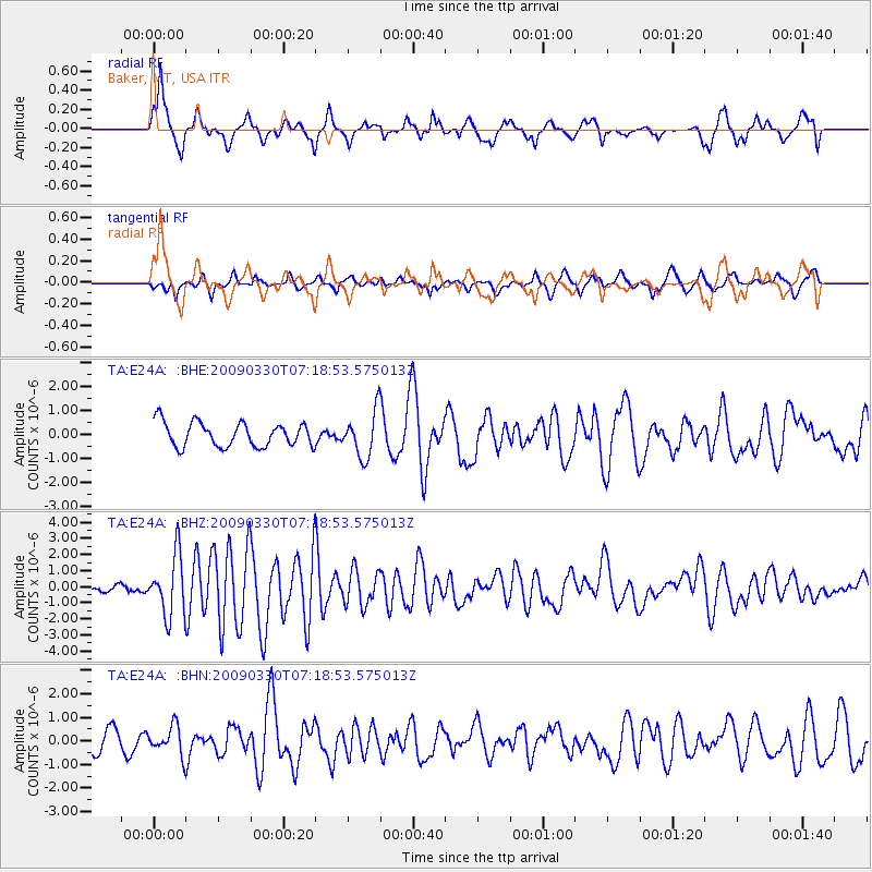
E24A Baker, MT, USA - Earthquake Result Viewer
*The percent match for this event was below the threshold and hence no stack was calculated.
| Earthquake location: |
Kodiak Island Region, Alaska |
| Earthquake latitude/longitude: |
56.5/-152.7 |
| Earthquake time(UTC): |
2009/03/30 (089) 07:13:07 GMT |
| Earthquake Depth: |
21 km |
| Earthquake Magnitude: |
5.9 MB, 5.9 MS, 5.9 MW, 5.9 MW |
| Earthquake Catalog/Contributor: |
WHDF/NEIC |
|
| Network: |
TA USArray Transportable Network (new EarthScope stations) |
| Station: |
E24A Baker, MT, USA |
| Lat/Lon: |
46.56 N/104.31 W |
| Elevation: |
912 m |
|
| Distance: |
31.1 deg |
| Az: |
87.815 deg |
| Baz: |
306.672 deg |
| Ray Param: |
$rayparam |
*The percent match for this event was below the threshold and hence was not used in the summary stack. |
|
| Radial Match: |
73.61665 % |
| Radial Bump: |
400 |
| Transverse Match: |
63.03271 % |
| Transverse Bump: |
400 |
| SOD ConfigId: |
2658 |
| Insert Time: |
2010-03-06 18:31:51.168 +0000 |
| GWidth: |
2.5 |
| Max Bumps: |
400 |
| Tol: |
0.001 |
|
Signal To Noise
| Channel | StoN | STA | LTA |
| TA:E24A: :BHZ:20090330T07:18:53.575013Z | 9.153907 | 1.8524304E-6 | 2.02365E-7 |
| TA:E24A: :BHN:20090330T07:18:53.575013Z | 1.1728735 | 6.035686E-7 | 5.1460677E-7 |
| TA:E24A: :BHE:20090330T07:18:53.575013Z | 1.8935952 | 9.4421614E-7 | 4.986367E-7 |
| Arrivals |
| Ps | |
| PpPs | |
| PsPs/PpSs | |


