You are here: Home > Network List > TA - USArray Transportable Network (new EarthScope stations) Stations List
> Station M16K Timber Creek, AK, USA > Earthquake Result Viewer
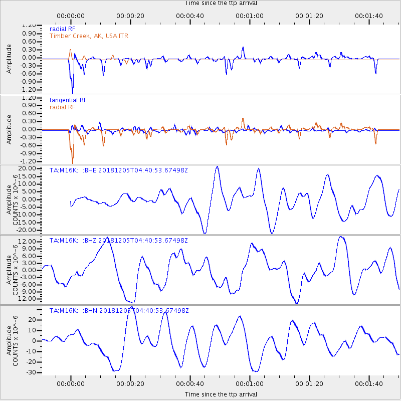
M16K Timber Creek, AK, USA - Earthquake Result Viewer
*The percent match for this event was below the threshold and hence no stack was calculated.
| Earthquake location: |
Southeast Of Loyalty Islands |
| Earthquake latitude/longitude: |
-21.5/169.4 |
| Earthquake time(UTC): |
2018/12/05 (339) 04:28:44 GMT |
| Earthquake Depth: |
10 km |
| Earthquake Magnitude: |
5.9 mb |
| Earthquake Catalog/Contributor: |
NEIC PDE/us |
|
| Network: |
TA USArray Transportable Network (new EarthScope stations) |
| Station: |
M16K Timber Creek, AK, USA |
| Lat/Lon: |
61.02 N/158.96 W |
| Elevation: |
394 m |
|
| Distance: |
86.1 deg |
| Az: |
14.849 deg |
| Baz: |
209.344 deg |
| Ray Param: |
$rayparam |
*The percent match for this event was below the threshold and hence was not used in the summary stack. |
|
| Radial Match: |
54.819454 % |
| Radial Bump: |
238 |
| Transverse Match: |
41.584034 % |
| Transverse Bump: |
400 |
| SOD ConfigId: |
13570011 |
| Insert Time: |
2019-05-02 00:26:04.655 +0000 |
| GWidth: |
2.5 |
| Max Bumps: |
400 |
| Tol: |
0.001 |
|
Signal To Noise
| Channel | StoN | STA | LTA |
| TA:M16K: :BHZ:20181205T04:40:53.67498Z | 1.1223212 | 2.4187088E-6 | 2.155095E-6 |
| TA:M16K: :BHN:20181205T04:40:53.67498Z | 3.3157105 | 7.3805386E-6 | 2.2259296E-6 |
| TA:M16K: :BHE:20181205T04:40:53.67498Z | 2.3748837 | 5.276264E-6 | 2.2216936E-6 |
| Arrivals |
| Ps | |
| PpPs | |
| PsPs/PpSs | |


