You are here: Home > Network List > UW - Pacific Northwest Regional Seismic Network Stations List
> Station UMAT Pilot Rock, OR, USA > Earthquake Result Viewer
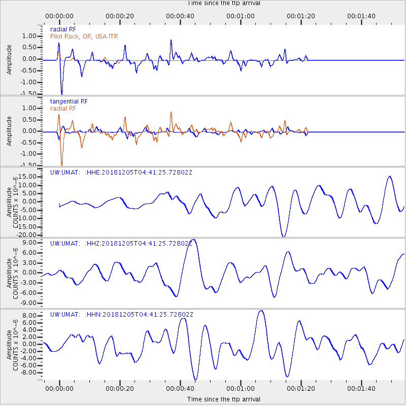
UMAT Pilot Rock, OR, USA - Earthquake Result Viewer
*The percent match for this event was below the threshold and hence no stack was calculated.
| Earthquake location: |
Southeast Of Loyalty Islands |
| Earthquake latitude/longitude: |
-21.5/169.4 |
| Earthquake time(UTC): |
2018/12/05 (339) 04:28:44 GMT |
| Earthquake Depth: |
10 km |
| Earthquake Magnitude: |
5.9 mb |
| Earthquake Catalog/Contributor: |
NEIC PDE/us |
|
| Network: |
UW Pacific Northwest Regional Seismic Network |
| Station: |
UMAT Pilot Rock, OR, USA |
| Lat/Lon: |
45.29 N/118.96 W |
| Elevation: |
1318 m |
|
| Distance: |
93.0 deg |
| Az: |
42.143 deg |
| Baz: |
242.266 deg |
| Ray Param: |
$rayparam |
*The percent match for this event was below the threshold and hence was not used in the summary stack. |
|
| Radial Match: |
46.93913 % |
| Radial Bump: |
313 |
| Transverse Match: |
46.701836 % |
| Transverse Bump: |
323 |
| SOD ConfigId: |
13570011 |
| Insert Time: |
2019-05-02 00:27:45.675 +0000 |
| GWidth: |
2.5 |
| Max Bumps: |
400 |
| Tol: |
0.001 |
|
Signal To Noise
| Channel | StoN | STA | LTA |
| UW:UMAT: :HHZ:20181205T04:41:25.72802Z | 1.1190724 | 1.1086382E-6 | 9.906761E-7 |
| UW:UMAT: :HHN:20181205T04:41:25.72802Z | 1.8540552 | 1.889462E-6 | 1.019097E-6 |
| UW:UMAT: :HHE:20181205T04:41:25.72802Z | 1.9823033 | 3.6603462E-6 | 1.8465117E-6 |
| Arrivals |
| Ps | |
| PpPs | |
| PsPs/PpSs | |


