You are here: Home > Network List > TS - TERRAscope (Southern California Seismic Network) Stations List
> Station BAR Barrett Dam, California, USA > Earthquake Result Viewer
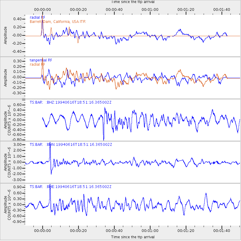
BAR Barrett Dam, California, USA - Earthquake Result Viewer
*The percent match for this event was below the threshold and hence no stack was calculated.
| Earthquake location: |
Southern Peru |
| Earthquake latitude/longitude: |
-15.2/-70.3 |
| Earthquake time(UTC): |
1994/06/16 (167) 18:41:31 GMT |
| Earthquake Depth: |
225 km |
| Earthquake Magnitude: |
5.6 MB, 5.8 UNKNOWN, 6.1 MW |
| Earthquake Catalog/Contributor: |
WHDF/NEIC |
|
| Network: |
TS TERRAscope (Southern California Seismic Network) |
| Station: |
BAR Barrett Dam, California, USA |
| Lat/Lon: |
32.68 N/116.67 W |
| Elevation: |
548 m |
|
| Distance: |
65.0 deg |
| Az: |
317.702 deg |
| Baz: |
129.601 deg |
| Ray Param: |
$rayparam |
*The percent match for this event was below the threshold and hence was not used in the summary stack. |
|
| Radial Match: |
74.100494 % |
| Radial Bump: |
400 |
| Transverse Match: |
69.625595 % |
| Transverse Bump: |
400 |
| SOD ConfigId: |
4480 |
| Insert Time: |
2010-02-26 14:01:38.358 +0000 |
| GWidth: |
2.5 |
| Max Bumps: |
400 |
| Tol: |
0.001 |
|
Signal To Noise
| Channel | StoN | STA | LTA |
| TS:BAR: :BHN:19940616T18:51:16.365002Z | 6.3946586 | 9.758186E-7 | 1.52599E-7 |
| TS:BAR: :BHE:19940616T18:51:16.365002Z | 2.3613214 | 2.9321956E-7 | 1.2417604E-7 |
| TS:BAR: :BHZ:19940616T18:51:16.365002Z | 1.5091609 | 2.6979578E-7 | 1.7877204E-7 |
| Arrivals |
| Ps | |
| PpPs | |
| PsPs/PpSs | |


