You are here: Home > Network List > TA - USArray Transportable Network (new EarthScope stations) Stations List
> Station R33M Jennings River, BC, CAN > Earthquake Result Viewer
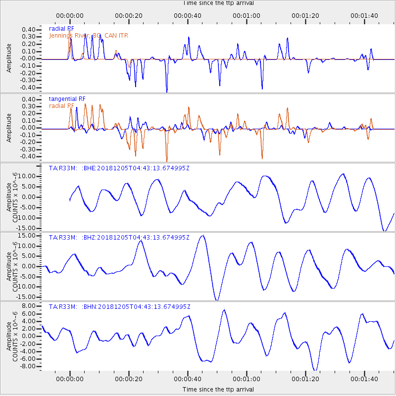
R33M Jennings River, BC, CAN - Earthquake Result Viewer
*The percent match for this event was below the threshold and hence no stack was calculated.
| Earthquake location: |
Southeast Of Loyalty Islands |
| Earthquake latitude/longitude: |
-21.8/169.1 |
| Earthquake time(UTC): |
2018/12/05 (339) 04:30:24 GMT |
| Earthquake Depth: |
10 km |
| Earthquake Magnitude: |
5.9 mb |
| Earthquake Catalog/Contributor: |
NEIC PDE/us |
|
| Network: |
TA USArray Transportable Network (new EarthScope stations) |
| Station: |
R33M Jennings River, BC, CAN |
| Lat/Lon: |
59.39 N/130.97 W |
| Elevation: |
1437 m |
|
| Distance: |
94.6 deg |
| Az: |
26.371 deg |
| Baz: |
233.764 deg |
| Ray Param: |
$rayparam |
*The percent match for this event was below the threshold and hence was not used in the summary stack. |
|
| Radial Match: |
54.074795 % |
| Radial Bump: |
248 |
| Transverse Match: |
79.96051 % |
| Transverse Bump: |
400 |
| SOD ConfigId: |
13570011 |
| Insert Time: |
2019-05-02 00:33:24.924 +0000 |
| GWidth: |
2.5 |
| Max Bumps: |
400 |
| Tol: |
0.001 |
|
Signal To Noise
| Channel | StoN | STA | LTA |
| TA:R33M: :BHZ:20181205T04:43:13.674995Z | 2.877485 | 4.2760353E-6 | 1.4860321E-6 |
| TA:R33M: :BHN:20181205T04:43:13.674995Z | 1.449654 | 3.1776187E-6 | 2.1919843E-6 |
| TA:R33M: :BHE:20181205T04:43:13.674995Z | 1.494885 | 6.2580534E-6 | 4.186311E-6 |
| Arrivals |
| Ps | |
| PpPs | |
| PsPs/PpSs | |


