You are here: Home > Network List > TA - USArray Transportable Network (new EarthScope stations) Stations List
> Station 121A Cookes Peak, Deming, NM, USA > Earthquake Result Viewer
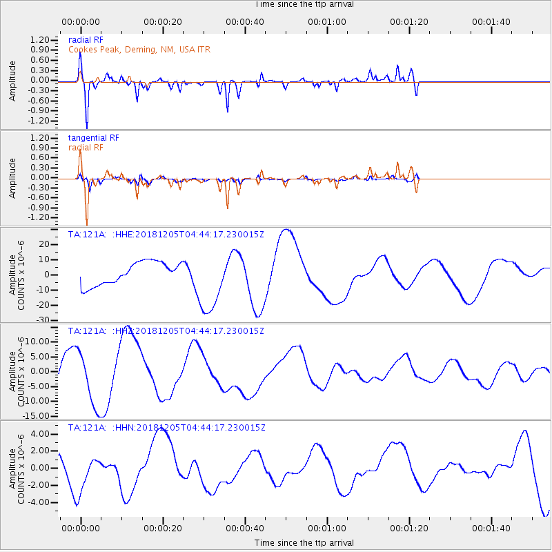
121A Cookes Peak, Deming, NM, USA - Earthquake Result Viewer
*The percent match for this event was below the threshold and hence no stack was calculated.
| Earthquake location: |
Southeast Of Loyalty Islands |
| Earthquake latitude/longitude: |
-21.9/169.5 |
| Earthquake time(UTC): |
2018/12/05 (339) 04:31:23 GMT |
| Earthquake Depth: |
10 km |
| Earthquake Magnitude: |
5.6 mb |
| Earthquake Catalog/Contributor: |
NEIC PDE/us |
|
| Network: |
TA USArray Transportable Network (new EarthScope stations) |
| Station: |
121A Cookes Peak, Deming, NM, USA |
| Lat/Lon: |
32.53 N/107.79 W |
| Elevation: |
1652 m |
|
| Distance: |
95.6 deg |
| Az: |
57.341 deg |
| Baz: |
247.778 deg |
| Ray Param: |
$rayparam |
*The percent match for this event was below the threshold and hence was not used in the summary stack. |
|
| Radial Match: |
66.74069 % |
| Radial Bump: |
294 |
| Transverse Match: |
64.44115 % |
| Transverse Bump: |
396 |
| SOD ConfigId: |
13570011 |
| Insert Time: |
2019-05-02 00:39:28.186 +0000 |
| GWidth: |
2.5 |
| Max Bumps: |
400 |
| Tol: |
0.001 |
|
Signal To Noise
| Channel | StoN | STA | LTA |
| TA:121A: :HHZ:20181205T04:44:17.230015Z | 1.8516304 | 9.107276E-6 | 4.918517E-6 |
| TA:121A: :HHN:20181205T04:44:17.230015Z | 1.5106431 | 2.124213E-6 | 1.4061648E-6 |
| TA:121A: :HHE:20181205T04:44:17.230015Z | 2.8538568 | 2.1043743E-5 | 7.3737906E-6 |
| Arrivals |
| Ps | |
| PpPs | |
| PsPs/PpSs | |


