You are here: Home > Network List > TA - USArray Transportable Network (new EarthScope stations) Stations List
> Station D23K Nanushuk River, AK USA > Earthquake Result Viewer
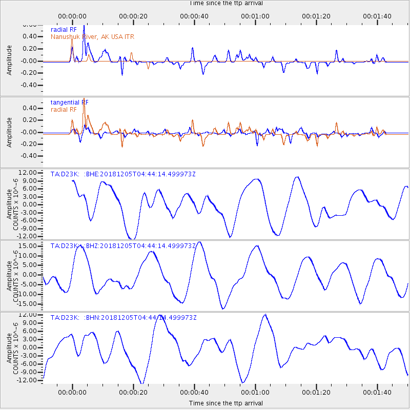
D23K Nanushuk River, AK USA - Earthquake Result Viewer
*The percent match for this event was below the threshold and hence no stack was calculated.
| Earthquake location: |
Southeast Of Loyalty Islands |
| Earthquake latitude/longitude: |
-21.9/169.5 |
| Earthquake time(UTC): |
2018/12/05 (339) 04:31:23 GMT |
| Earthquake Depth: |
10 km |
| Earthquake Magnitude: |
5.6 mb |
| Earthquake Catalog/Contributor: |
NEIC PDE/us |
|
| Network: |
TA USArray Transportable Network (new EarthScope stations) |
| Station: |
D23K Nanushuk River, AK USA |
| Lat/Lon: |
68.97 N/150.68 W |
| Elevation: |
406 m |
|
| Distance: |
95.0 deg |
| Az: |
13.409 deg |
| Baz: |
216.626 deg |
| Ray Param: |
$rayparam |
*The percent match for this event was below the threshold and hence was not used in the summary stack. |
|
| Radial Match: |
54.163177 % |
| Radial Bump: |
303 |
| Transverse Match: |
40.93425 % |
| Transverse Bump: |
400 |
| SOD ConfigId: |
13570011 |
| Insert Time: |
2019-05-02 00:39:31.990 +0000 |
| GWidth: |
2.5 |
| Max Bumps: |
400 |
| Tol: |
0.001 |
|
Signal To Noise
| Channel | StoN | STA | LTA |
| TA:D23K: :BHZ:20181205T04:44:14.499973Z | 2.3853204 | 1.1798109E-5 | 4.9461314E-6 |
| TA:D23K: :BHN:20181205T04:44:14.499973Z | 0.5194828 | 3.392401E-6 | 6.5303434E-6 |
| TA:D23K: :BHE:20181205T04:44:14.499973Z | 0.4568052 | 3.1213742E-6 | 6.8330532E-6 |
| Arrivals |
| Ps | |
| PpPs | |
| PsPs/PpSs | |


