You are here: Home > Network List > TA - USArray Transportable Network (new EarthScope stations) Stations List
> Station H31M Peel River, Yukon, CAN > Earthquake Result Viewer
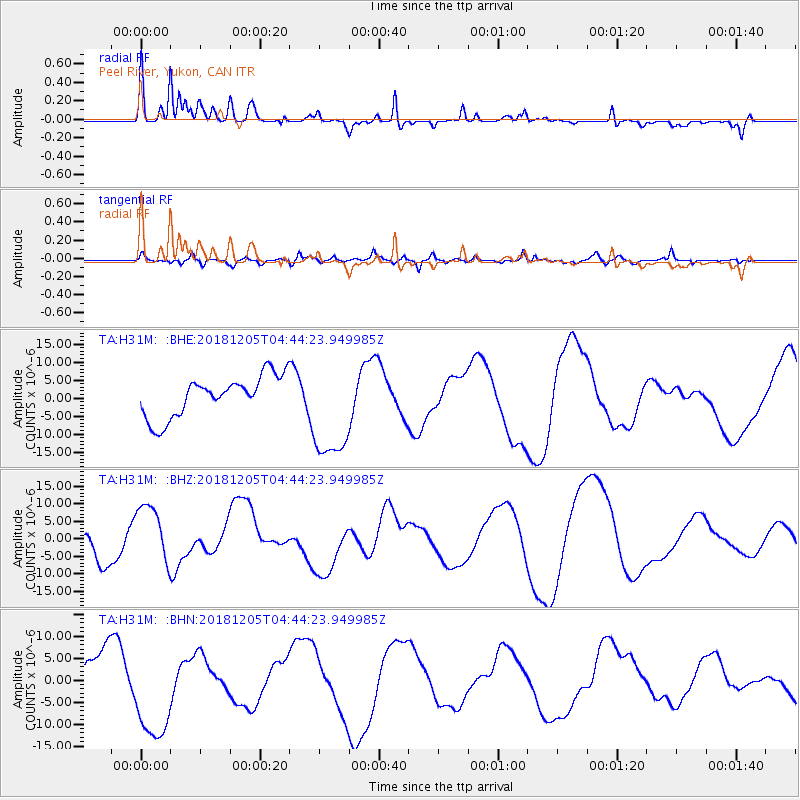
H31M Peel River, Yukon, CAN - Earthquake Result Viewer
*The percent match for this event was below the threshold and hence no stack was calculated.
| Earthquake location: |
Southeast Of Loyalty Islands |
| Earthquake latitude/longitude: |
-21.9/169.5 |
| Earthquake time(UTC): |
2018/12/05 (339) 04:31:23 GMT |
| Earthquake Depth: |
10 km |
| Earthquake Magnitude: |
5.6 mb |
| Earthquake Catalog/Contributor: |
NEIC PDE/us |
|
| Network: |
TA USArray Transportable Network (new EarthScope stations) |
| Station: |
H31M Peel River, Yukon, CAN |
| Lat/Lon: |
65.81 N/134.34 W |
| Elevation: |
642 m |
|
| Distance: |
97.1 deg |
| Az: |
20.17 deg |
| Baz: |
230.996 deg |
| Ray Param: |
$rayparam |
*The percent match for this event was below the threshold and hence was not used in the summary stack. |
|
| Radial Match: |
30.435883 % |
| Radial Bump: |
277 |
| Transverse Match: |
47.48601 % |
| Transverse Bump: |
400 |
| SOD ConfigId: |
13570011 |
| Insert Time: |
2019-05-02 00:39:51.094 +0000 |
| GWidth: |
2.5 |
| Max Bumps: |
400 |
| Tol: |
0.001 |
|
Signal To Noise
| Channel | StoN | STA | LTA |
| TA:H31M: :BHZ:20181205T04:44:23.949985Z | 1.7093433 | 8.564413E-6 | 5.010353E-6 |
| TA:H31M: :BHN:20181205T04:44:23.949985Z | 2.6192684 | 1.1223122E-5 | 4.2848305E-6 |
| TA:H31M: :BHE:20181205T04:44:23.949985Z | 2.6056733 | 1.4768691E-5 | 5.6678978E-6 |
| Arrivals |
| Ps | |
| PpPs | |
| PsPs/PpSs | |


