You are here: Home > Network List > TA - USArray Transportable Network (new EarthScope stations) Stations List
> Station R31K City Hall, Gustavus, AK, USA > Earthquake Result Viewer
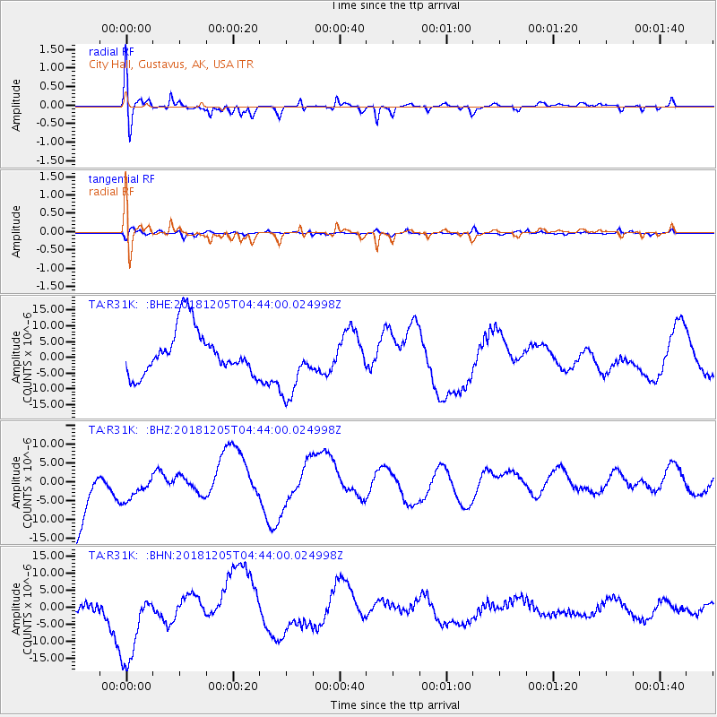
R31K City Hall, Gustavus, AK, USA - Earthquake Result Viewer
*The percent match for this event was below the threshold and hence no stack was calculated.
| Earthquake location: |
Southeast Of Loyalty Islands |
| Earthquake latitude/longitude: |
-21.9/169.5 |
| Earthquake time(UTC): |
2018/12/05 (339) 04:31:23 GMT |
| Earthquake Depth: |
10 km |
| Earthquake Magnitude: |
5.6 mb |
| Earthquake Catalog/Contributor: |
NEIC PDE/us |
|
| Network: |
TA USArray Transportable Network (new EarthScope stations) |
| Station: |
R31K City Hall, Gustavus, AK, USA |
| Lat/Lon: |
58.41 N/135.74 W |
| Elevation: |
15 m |
|
| Distance: |
91.9 deg |
| Az: |
25.461 deg |
| Baz: |
229.344 deg |
| Ray Param: |
$rayparam |
*The percent match for this event was below the threshold and hence was not used in the summary stack. |
|
| Radial Match: |
62.58715 % |
| Radial Bump: |
400 |
| Transverse Match: |
63.427505 % |
| Transverse Bump: |
291 |
| SOD ConfigId: |
13570011 |
| Insert Time: |
2019-05-02 00:40:11.565 +0000 |
| GWidth: |
2.5 |
| Max Bumps: |
400 |
| Tol: |
0.001 |
|
Signal To Noise
| Channel | StoN | STA | LTA |
| TA:R31K: :BHZ:20181205T04:44:00.024998Z | 0.321846 | 3.8765083E-6 | 1.2044605E-5 |
| TA:R31K: :BHN:20181205T04:44:00.024998Z | 1.2217962 | 1.1858762E-5 | 9.7060065E-6 |
| TA:R31K: :BHE:20181205T04:44:00.024998Z | 1.4470603 | 1.0472813E-5 | 7.2373023E-6 |
| Arrivals |
| Ps | |
| PpPs | |
| PsPs/PpSs | |


