You are here: Home > Network List > UW - Pacific Northwest Regional Seismic Network Stations List
> Station HOOD Mt Hood Meadows, OR CREST BB SMO > Earthquake Result Viewer
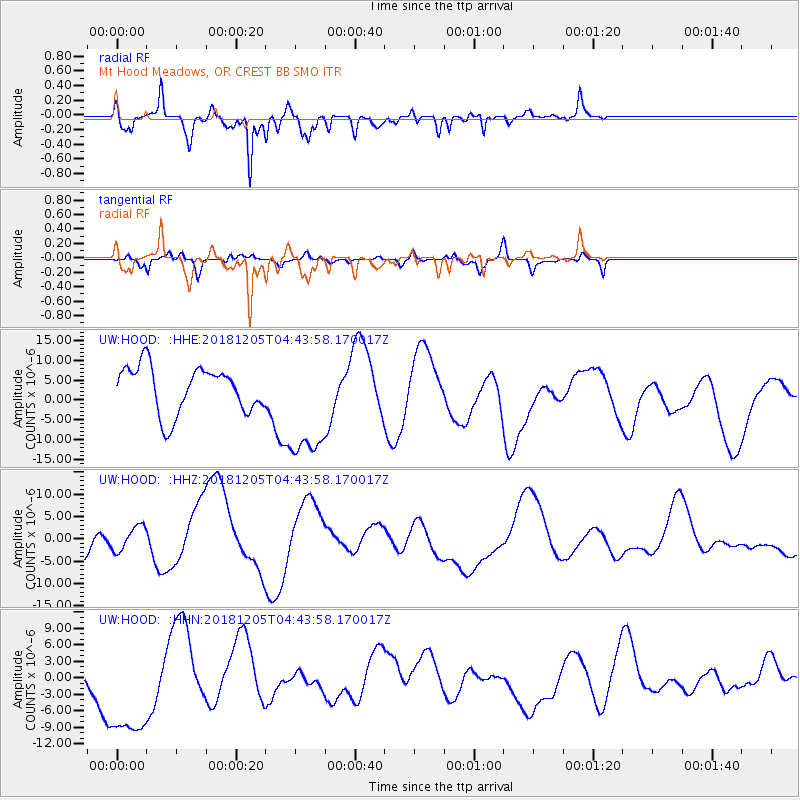
HOOD Mt Hood Meadows, OR CREST BB SMO - Earthquake Result Viewer
*The percent match for this event was below the threshold and hence no stack was calculated.
| Earthquake location: |
Southeast Of Loyalty Islands |
| Earthquake latitude/longitude: |
-21.9/169.5 |
| Earthquake time(UTC): |
2018/12/05 (339) 04:31:23 GMT |
| Earthquake Depth: |
10 km |
| Earthquake Magnitude: |
5.6 mb |
| Earthquake Catalog/Contributor: |
NEIC PDE/us |
|
| Network: |
UW Pacific Northwest Regional Seismic Network |
| Station: |
HOOD Mt Hood Meadows, OR CREST BB SMO |
| Lat/Lon: |
45.32 N/121.65 W |
| Elevation: |
1520 m |
|
| Distance: |
91.5 deg |
| Az: |
41.148 deg |
| Baz: |
240.03 deg |
| Ray Param: |
$rayparam |
*The percent match for this event was below the threshold and hence was not used in the summary stack. |
|
| Radial Match: |
66.73484 % |
| Radial Bump: |
400 |
| Transverse Match: |
51.508003 % |
| Transverse Bump: |
332 |
| SOD ConfigId: |
13570011 |
| Insert Time: |
2019-05-02 00:40:42.149 +0000 |
| GWidth: |
2.5 |
| Max Bumps: |
400 |
| Tol: |
0.001 |
|
Signal To Noise
| Channel | StoN | STA | LTA |
| UW:HOOD: :HHZ:20181205T04:43:58.170017Z | 0.33343223 | 2.7850956E-6 | 8.352808E-6 |
| UW:HOOD: :HHN:20181205T04:43:58.170017Z | 3.0305872 | 1.0821881E-5 | 3.5708858E-6 |
| UW:HOOD: :HHE:20181205T04:43:58.170017Z | 2.5253239 | 1.4693201E-5 | 5.818343E-6 |
| Arrivals |
| Ps | |
| PpPs | |
| PsPs/PpSs | |


