You are here: Home > Network List > IU - Global Seismograph Network (GSN - IRIS/USGS) Stations List
> Station CTAO Charters Towers, Australia > Earthquake Result Viewer
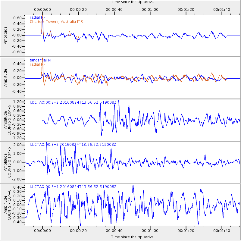
CTAO Charters Towers, Australia - Earthquake Result Viewer
*The percent match for this event was below the threshold and hence no stack was calculated.
| Earthquake location: |
Southern Sumatra, Indonesia |
| Earthquake latitude/longitude: |
-3.0/100.1 |
| Earthquake time(UTC): |
2016/08/24 (237) 13:48:44 GMT |
| Earthquake Depth: |
17 km |
| Earthquake Magnitude: |
5.8 MB |
| Earthquake Catalog/Contributor: |
NEIC PDE/NEIC COMCAT |
|
| Network: |
IU Global Seismograph Network (GSN - IRIS/USGS) |
| Station: |
CTAO Charters Towers, Australia |
| Lat/Lon: |
20.09 S/146.25 E |
| Elevation: |
357 m |
|
| Distance: |
48.1 deg |
| Az: |
114.395 deg |
| Baz: |
284.607 deg |
| Ray Param: |
$rayparam |
*The percent match for this event was below the threshold and hence was not used in the summary stack. |
|
| Radial Match: |
75.922455 % |
| Radial Bump: |
363 |
| Transverse Match: |
59.34126 % |
| Transverse Bump: |
400 |
| SOD ConfigId: |
1634031 |
| Insert Time: |
2016-09-07 13:50:42.337 +0000 |
| GWidth: |
2.5 |
| Max Bumps: |
400 |
| Tol: |
0.001 |
|
Signal To Noise
| Channel | StoN | STA | LTA |
| IU:CTAO:00:BHZ:20160824T13:56:52.519008Z | 4.884894 | 8.046934E-7 | 1.6473099E-7 |
| IU:CTAO:00:BH1:20160824T13:56:52.519008Z | 1.0288429 | 1.997058E-7 | 1.9410717E-7 |
| IU:CTAO:00:BH2:20160824T13:56:52.519008Z | 2.5061588 | 4.7179108E-7 | 1.8825267E-7 |
| Arrivals |
| Ps | |
| PpPs | |
| PsPs/PpSs | |


