You are here: Home > Network List > TA - USArray Transportable Network (new EarthScope stations) Stations List
> Station A15A Johnson Ranch, Cut Bank, MT, USA > Earthquake Result Viewer
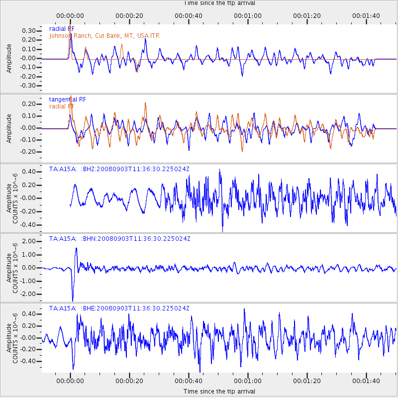
A15A Johnson Ranch, Cut Bank, MT, USA - Earthquake Result Viewer
*The percent match for this event was below the threshold and hence no stack was calculated.
| Earthquake location: |
Santiago Del Estero Prov., Arg. |
| Earthquake latitude/longitude: |
-26.7/-63.2 |
| Earthquake time(UTC): |
2008/09/03 (247) 11:25:14 GMT |
| Earthquake Depth: |
570 km |
| Earthquake Magnitude: |
5.9 MB, 6.3 MW, 6.3 MW |
| Earthquake Catalog/Contributor: |
WHDF/NEIC |
|
| Network: |
TA USArray Transportable Network (new EarthScope stations) |
| Station: |
A15A Johnson Ranch, Cut Bank, MT, USA |
| Lat/Lon: |
48.98 N/112.73 W |
| Elevation: |
1236 m |
|
| Distance: |
87.4 deg |
| Az: |
329.895 deg |
| Baz: |
137.092 deg |
| Ray Param: |
$rayparam |
*The percent match for this event was below the threshold and hence was not used in the summary stack. |
|
| Radial Match: |
66.30938 % |
| Radial Bump: |
349 |
| Transverse Match: |
59.316364 % |
| Transverse Bump: |
369 |
| SOD ConfigId: |
2504 |
| Insert Time: |
2010-03-06 18:34:28.933 +0000 |
| GWidth: |
2.5 |
| Max Bumps: |
400 |
| Tol: |
0.001 |
|
Signal To Noise
| Channel | StoN | STA | LTA |
| TA:A15A: :BHN:20080903T11:36:30.225024Z | 9.802547 | 8.514259E-7 | 8.685761E-8 |
| TA:A15A: :BHE:20080903T11:36:30.225024Z | 2.3406 | 2.3088246E-7 | 9.864243E-8 |
| TA:A15A: :BHZ:20080903T11:36:30.225024Z | 1.2153817 | 1.16432055E-7 | 9.5798754E-8 |
| Arrivals |
| Ps | |
| PpPs | |
| PsPs/PpSs | |


