You are here: Home > Network List > AZ - ANZA Regional Network Stations List
> Station SMER AZ.SMER > Earthquake Result Viewer
SMER AZ.SMER - Earthquake Result Viewer
*The percent match for this event was below the threshold and hence no stack was calculated.
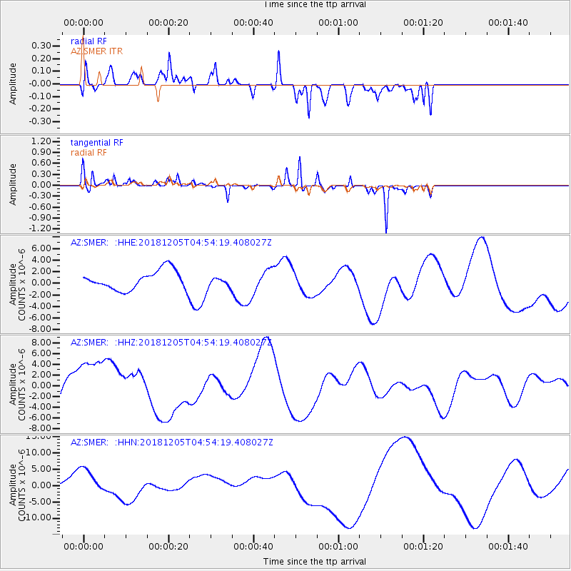
| Earthquake location: |
Southeast Of Loyalty Islands |
| Earthquake latitude/longitude: |
-21.7/169.2 |
| Earthquake time(UTC): |
2018/12/05 (339) 04:41:56 GMT |
| Earthquake Depth: |
10 km |
| Earthquake Magnitude: |
5.7 mb |
| Earthquake Catalog/Contributor: |
NEIC PDE/us |
|
| Network: |
AZ ANZA Regional Network |
| Station: |
SMER AZ.SMER |
| Lat/Lon: |
33.46 N/117.17 W |
| Elevation: |
355 m |
|
| Distance: |
89.0 deg |
| Az: |
53.327 deg |
| Baz: |
243.156 deg |
| Ray Param: |
$rayparam |
*The percent match for this event was below the threshold and hence was not used in the summary stack. |
|
| Radial Match: |
34.795105 % |
| Radial Bump: |
310 |
| Transverse Match: |
79.307014 % |
| Transverse Bump: |
240 |
| SOD ConfigId: |
13570011 |
| Insert Time: |
2019-05-02 00:42:48.105 +0000 |
| GWidth: |
2.5 |
| Max Bumps: |
400 |
| Tol: |
0.001 |
|
Signal To Noise
| Channel | StoN | STA | LTA |
| AZ:SMER: :HHZ:20181205T04:54:19.408027Z | 3.134527 | 5.7281577E-6 | 1.8274392E-6 |
| AZ:SMER: :HHN:20181205T04:54:19.408027Z | 1.5280933 | 4.284403E-6 | 2.8037575E-6 |
| AZ:SMER: :HHE:20181205T04:54:19.408027Z | 0.5211617 | 8.549811E-7 | 1.6405295E-6 |
| Arrivals |
| Ps | |
| PpPs | |
| PsPs/PpSs | |


