You are here: Home > Network List > TA - USArray Transportable Network (new EarthScope stations) Stations List
> Station A15A Johnson Ranch, Cut Bank, MT, USA > Earthquake Result Viewer
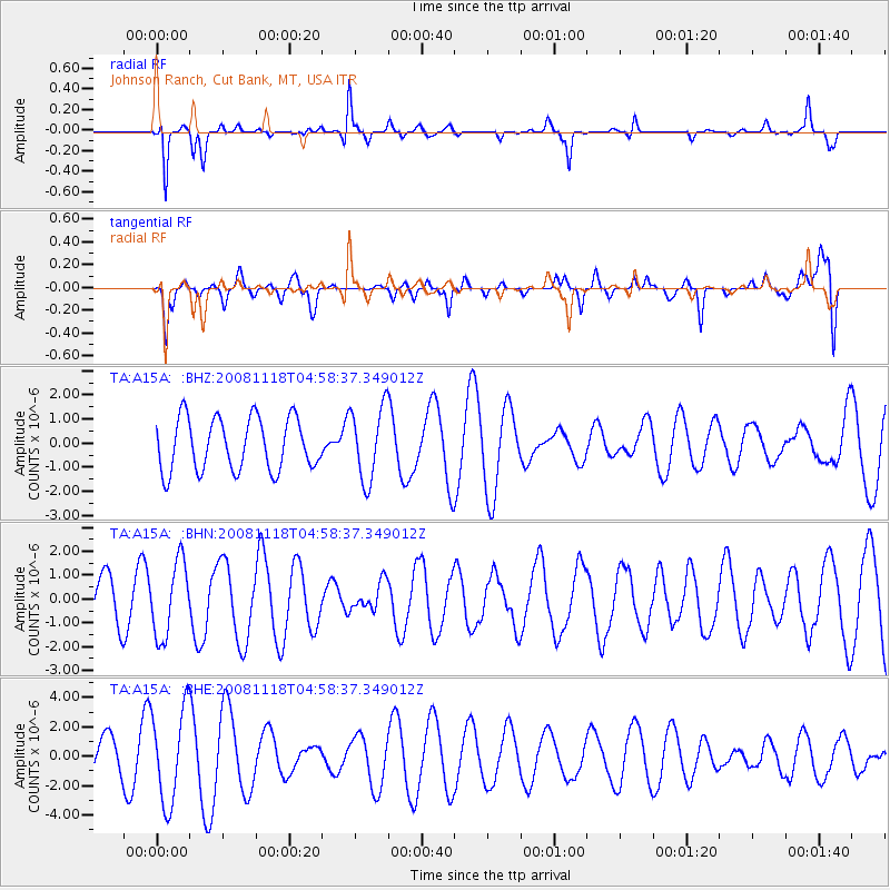
A15A Johnson Ranch, Cut Bank, MT, USA - Earthquake Result Viewer
*The percent match for this event was below the threshold and hence no stack was calculated.
| Earthquake location: |
Arctic Ocean |
| Earthquake latitude/longitude: |
79.7/-115.5 |
| Earthquake time(UTC): |
2008/11/18 (323) 04:52:51 GMT |
| Earthquake Depth: |
10 km |
| Earthquake Magnitude: |
5.6 ML, 5.3 MB |
| Earthquake Catalog/Contributor: |
WHDF/NEIC |
|
| Network: |
TA USArray Transportable Network (new EarthScope stations) |
| Station: |
A15A Johnson Ranch, Cut Bank, MT, USA |
| Lat/Lon: |
48.98 N/112.73 W |
| Elevation: |
1236 m |
|
| Distance: |
30.9 deg |
| Az: |
176.509 deg |
| Baz: |
359.051 deg |
| Ray Param: |
$rayparam |
*The percent match for this event was below the threshold and hence was not used in the summary stack. |
|
| Radial Match: |
67.91368 % |
| Radial Bump: |
235 |
| Transverse Match: |
69.48751 % |
| Transverse Bump: |
400 |
| SOD ConfigId: |
2658 |
| Insert Time: |
2010-03-06 18:34:40.306 +0000 |
| GWidth: |
2.5 |
| Max Bumps: |
400 |
| Tol: |
0.001 |
|
Signal To Noise
| Channel | StoN | STA | LTA |
| TA:A15A: :BHN:20081118T04:58:37.349012Z | 0.9566315 | 1.5589363E-6 | 1.6296102E-6 |
| TA:A15A: :BHE:20081118T04:58:37.349012Z | 2.0951152 | 3.1948753E-6 | 1.5249162E-6 |
| TA:A15A: :BHZ:20081118T04:58:37.349012Z | 1.3961912 | 1.5121202E-6 | 1.0830322E-6 |
| Arrivals |
| Ps | |
| PpPs | |
| PsPs/PpSs | |


