You are here: Home > Network List > TA - USArray Transportable Network (new EarthScope stations) Stations List
> Station E20K Nigu River, AK, USA > Earthquake Result Viewer
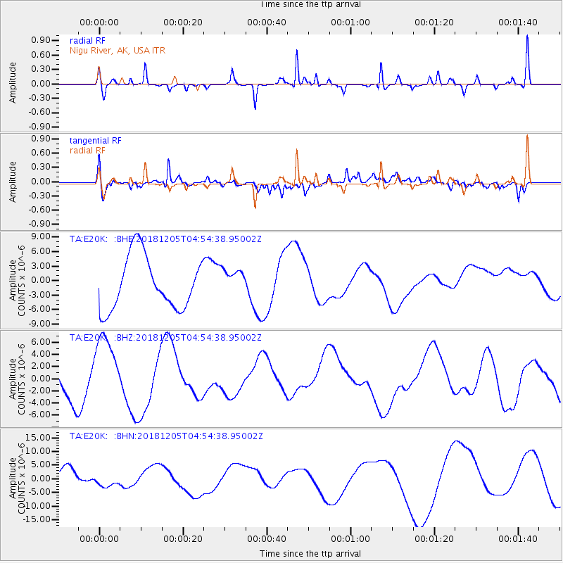
E20K Nigu River, AK, USA - Earthquake Result Viewer
*The percent match for this event was below the threshold and hence no stack was calculated.
| Earthquake location: |
Southeast Of Loyalty Islands |
| Earthquake latitude/longitude: |
-21.7/169.2 |
| Earthquake time(UTC): |
2018/12/05 (339) 04:41:56 GMT |
| Earthquake Depth: |
10 km |
| Earthquake Magnitude: |
5.7 mb |
| Earthquake Catalog/Contributor: |
NEIC PDE/us |
|
| Network: |
TA USArray Transportable Network (new EarthScope stations) |
| Station: |
E20K Nigu River, AK, USA |
| Lat/Lon: |
68.26 N/156.19 W |
| Elevation: |
866 m |
|
| Distance: |
93.2 deg |
| Az: |
12.224 deg |
| Baz: |
211.904 deg |
| Ray Param: |
$rayparam |
*The percent match for this event was below the threshold and hence was not used in the summary stack. |
|
| Radial Match: |
71.974 % |
| Radial Bump: |
214 |
| Transverse Match: |
61.332527 % |
| Transverse Bump: |
400 |
| SOD ConfigId: |
13570011 |
| Insert Time: |
2019-05-02 00:45:52.136 +0000 |
| GWidth: |
2.5 |
| Max Bumps: |
400 |
| Tol: |
0.001 |
|
Signal To Noise
| Channel | StoN | STA | LTA |
| TA:E20K: :BHZ:20181205T04:54:38.95002Z | 1.9630936 | 5.9286804E-6 | 3.0200702E-6 |
| TA:E20K: :BHN:20181205T04:54:38.95002Z | 0.63508123 | 2.0269554E-6 | 3.1916477E-6 |
| TA:E20K: :BHE:20181205T04:54:38.95002Z | 0.5015969 | 2.7254887E-6 | 5.4336238E-6 |
| Arrivals |
| Ps | |
| PpPs | |
| PsPs/PpSs | |


