You are here: Home > Network List > TA - USArray Transportable Network (new EarthScope stations) Stations List
> Station P17K Kvichak River, AK, USA > Earthquake Result Viewer
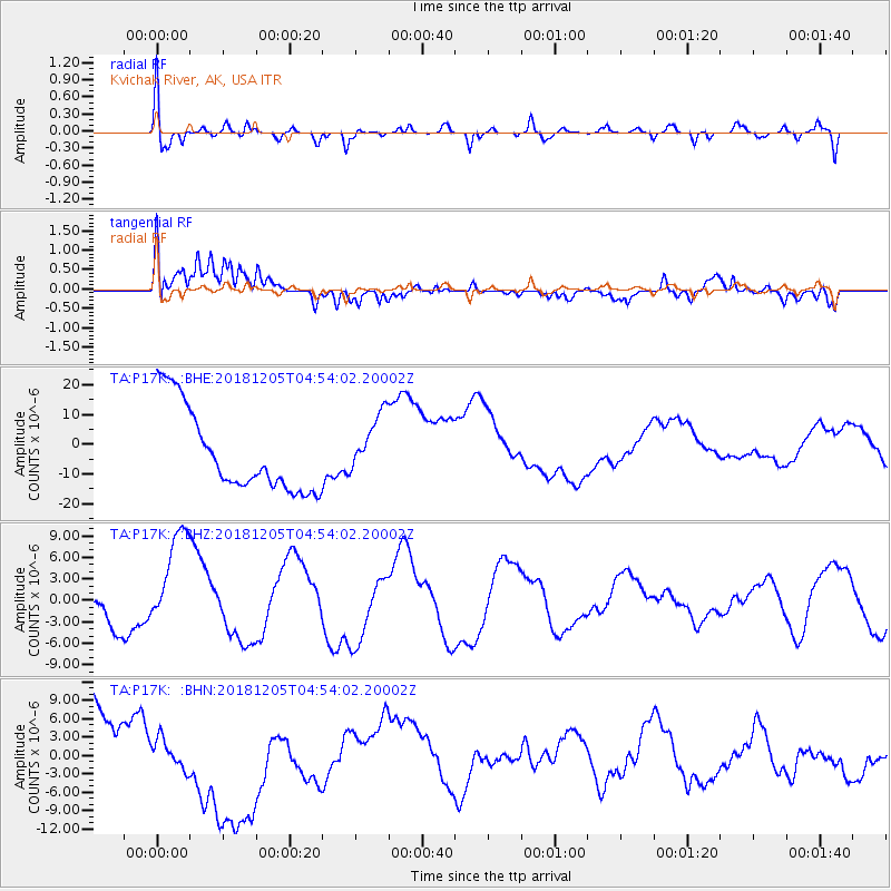
P17K Kvichak River, AK, USA - Earthquake Result Viewer
*The percent match for this event was below the threshold and hence no stack was calculated.
| Earthquake location: |
Southeast Of Loyalty Islands |
| Earthquake latitude/longitude: |
-21.7/169.2 |
| Earthquake time(UTC): |
2018/12/05 (339) 04:41:56 GMT |
| Earthquake Depth: |
10 km |
| Earthquake Magnitude: |
5.7 mb |
| Earthquake Catalog/Contributor: |
NEIC PDE/us |
|
| Network: |
TA USArray Transportable Network (new EarthScope stations) |
| Station: |
P17K Kvichak River, AK, USA |
| Lat/Lon: |
59.20 N/156.44 W |
| Elevation: |
91 m |
|
| Distance: |
85.4 deg |
| Az: |
16.923 deg |
| Baz: |
211.736 deg |
| Ray Param: |
$rayparam |
*The percent match for this event was below the threshold and hence was not used in the summary stack. |
|
| Radial Match: |
57.952747 % |
| Radial Bump: |
400 |
| Transverse Match: |
54.69355 % |
| Transverse Bump: |
380 |
| SOD ConfigId: |
13570011 |
| Insert Time: |
2019-05-02 00:46:23.993 +0000 |
| GWidth: |
2.5 |
| Max Bumps: |
400 |
| Tol: |
0.001 |
|
Signal To Noise
| Channel | StoN | STA | LTA |
| TA:P17K: :BHZ:20181205T04:54:02.20002Z | 4.3931746 | 7.740152E-6 | 1.7618585E-6 |
| TA:P17K: :BHN:20181205T04:54:02.20002Z | 0.28108191 | 2.4480503E-6 | 8.709383E-6 |
| TA:P17K: :BHE:20181205T04:54:02.20002Z | 0.7488673 | 1.0430932E-5 | 1.3928947E-5 |
| Arrivals |
| Ps | |
| PpPs | |
| PsPs/PpSs | |


