You are here: Home > Network List > TA - USArray Transportable Network (new EarthScope stations) Stations List
> Station A15A Johnson Ranch, Cut Bank, MT, USA > Earthquake Result Viewer
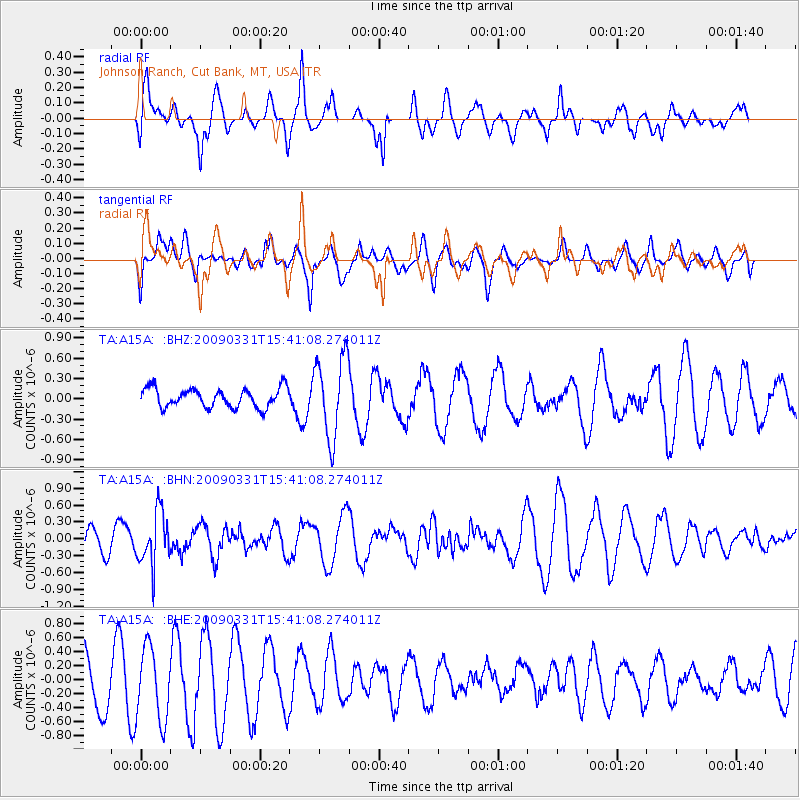
A15A Johnson Ranch, Cut Bank, MT, USA - Earthquake Result Viewer
*The percent match for this event was below the threshold and hence no stack was calculated.
| Earthquake location: |
Mariana Islands |
| Earthquake latitude/longitude: |
18.3/145.7 |
| Earthquake time(UTC): |
2009/03/31 (090) 15:29:31 GMT |
| Earthquake Depth: |
188 km |
| Earthquake Magnitude: |
5.5 MW, 5.4 MB, 5.4 MW |
| Earthquake Catalog/Contributor: |
WHDF/NEIC |
|
| Network: |
TA USArray Transportable Network (new EarthScope stations) |
| Station: |
A15A Johnson Ranch, Cut Bank, MT, USA |
| Lat/Lon: |
48.98 N/112.73 W |
| Elevation: |
1236 m |
|
| Distance: |
83.7 deg |
| Az: |
40.498 deg |
| Baz: |
290.548 deg |
| Ray Param: |
$rayparam |
*The percent match for this event was below the threshold and hence was not used in the summary stack. |
|
| Radial Match: |
68.4939 % |
| Radial Bump: |
400 |
| Transverse Match: |
33.14896 % |
| Transverse Bump: |
400 |
| SOD ConfigId: |
2658 |
| Insert Time: |
2010-03-06 18:35:40.644 +0000 |
| GWidth: |
2.5 |
| Max Bumps: |
400 |
| Tol: |
0.001 |
|
Signal To Noise
| Channel | StoN | STA | LTA |
| TA:A15A: :BHN:20090331T15:41:08.274011Z | 1.9829994 | 4.738917E-7 | 2.3897724E-7 |
| TA:A15A: :BHE:20090331T15:41:08.274011Z | 1.3221751 | 5.284063E-7 | 3.9964925E-7 |
| TA:A15A: :BHZ:20090331T15:41:08.274011Z | 4.236207 | 5.968647E-7 | 1.4089602E-7 |
| Arrivals |
| Ps | |
| PpPs | |
| PsPs/PpSs | |


