You are here: Home > Network List > TA - USArray Transportable Network (new EarthScope stations) Stations List
> Station A15A Johnson Ranch, Cut Bank, MT, USA > Earthquake Result Viewer
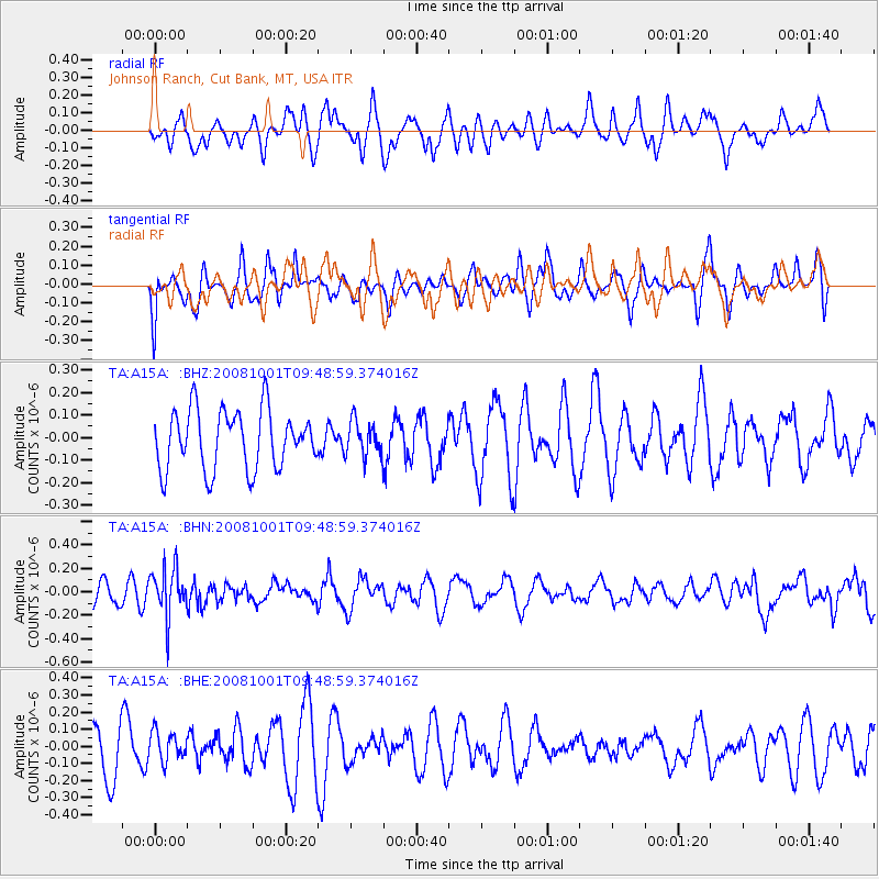
A15A Johnson Ranch, Cut Bank, MT, USA - Earthquake Result Viewer
*The percent match for this event was below the threshold and hence no stack was calculated.
| Earthquake location: |
Southeast Of Honshu, Japan |
| Earthquake latitude/longitude: |
30.2/138.8 |
| Earthquake time(UTC): |
2008/10/01 (275) 09:38:12 GMT |
| Earthquake Depth: |
414 km |
| Earthquake Magnitude: |
5.7 MW, 5.1 MB, 5.7 MW |
| Earthquake Catalog/Contributor: |
WHDF/NEIC |
|
| Network: |
TA USArray Transportable Network (new EarthScope stations) |
| Station: |
A15A Johnson Ranch, Cut Bank, MT, USA |
| Lat/Lon: |
48.98 N/112.73 W |
| Elevation: |
1236 m |
|
| Distance: |
78.7 deg |
| Az: |
39.577 deg |
| Baz: |
303.128 deg |
| Ray Param: |
$rayparam |
*The percent match for this event was below the threshold and hence was not used in the summary stack. |
|
| Radial Match: |
42.08437 % |
| Radial Bump: |
400 |
| Transverse Match: |
37.077335 % |
| Transverse Bump: |
367 |
| SOD ConfigId: |
2556 |
| Insert Time: |
2010-03-06 18:35:58.943 +0000 |
| GWidth: |
2.5 |
| Max Bumps: |
400 |
| Tol: |
0.001 |
|
Signal To Noise
| Channel | StoN | STA | LTA |
| TA:A15A: :BHN:20081001T09:48:59.374016Z | 1.9530817 | 1.9995981E-7 | 1.0238169E-7 |
| TA:A15A: :BHE:20081001T09:48:59.374016Z | 0.7987245 | 8.473374E-8 | 1.06086326E-7 |
| TA:A15A: :BHZ:20081001T09:48:59.374016Z | 0.57534194 | 7.519731E-8 | 1.3070022E-7 |
| Arrivals |
| Ps | |
| PpPs | |
| PsPs/PpSs | |


