You are here: Home > Network List > IU - Global Seismograph Network (GSN - IRIS/USGS) Stations List
> Station CTAO Charters Towers, Australia > Earthquake Result Viewer
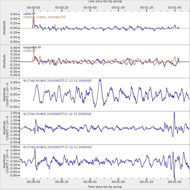
CTAO Charters Towers, Australia - Earthquake Result Viewer
*The percent match for this event was below the threshold and hence no stack was calculated.
| Earthquake location: |
Southeast Of Honshu, Japan |
| Earthquake latitude/longitude: |
30.6/137.8 |
| Earthquake time(UTC): |
2016/08/25 (238) 17:04:43 GMT |
| Earthquake Depth: |
456 km |
| Earthquake Magnitude: |
5.9 MWW, 5.9 MWB |
| Earthquake Catalog/Contributor: |
NEIC PDE/NEIC COMCAT |
|
| Network: |
IU Global Seismograph Network (GSN - IRIS/USGS) |
| Station: |
CTAO Charters Towers, Australia |
| Lat/Lon: |
20.09 S/146.25 E |
| Elevation: |
357 m |
|
| Distance: |
51.1 deg |
| Az: |
169.822 deg |
| Baz: |
350.672 deg |
| Ray Param: |
$rayparam |
*The percent match for this event was below the threshold and hence was not used in the summary stack. |
|
| Radial Match: |
47.61967 % |
| Radial Bump: |
360 |
| Transverse Match: |
49.88446 % |
| Transverse Bump: |
400 |
| SOD ConfigId: |
1634031 |
| Insert Time: |
2016-09-08 17:06:41.254 +0000 |
| GWidth: |
2.5 |
| Max Bumps: |
400 |
| Tol: |
0.001 |
|
Signal To Noise
| Channel | StoN | STA | LTA |
| IU:CTAO:00:BHZ:20160825T17:12:31.369009Z | 2.1232 | 4.5097775E-7 | 2.1240476E-7 |
| IU:CTAO:00:BH1:20160825T17:12:31.369009Z | 1.6257936 | 2.7200656E-7 | 1.6730695E-7 |
| IU:CTAO:00:BH2:20160825T17:12:31.369009Z | 1.0116513 | 1.5588074E-7 | 1.5408546E-7 |
| Arrivals |
| Ps | |
| PpPs | |
| PsPs/PpSs | |


