You are here: Home > Network List > TA - USArray Transportable Network (new EarthScope stations) Stations List
> Station 121A Cookes Peak, Deming, NM, USA > Earthquake Result Viewer
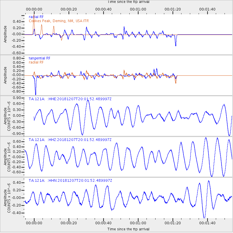
121A Cookes Peak, Deming, NM, USA - Earthquake Result Viewer
*The percent match for this event was below the threshold and hence no stack was calculated.
| Earthquake location: |
Southern Alaska |
| Earthquake latitude/longitude: |
61.3/-150.0 |
| Earthquake time(UTC): |
2018/12/07 (341) 19:54:54 GMT |
| Earthquake Depth: |
29 km |
| Earthquake Magnitude: |
3.5 ML |
| Earthquake Catalog/Contributor: |
NEIC PDE/ak |
|
| Network: |
TA USArray Transportable Network (new EarthScope stations) |
| Station: |
121A Cookes Peak, Deming, NM, USA |
| Lat/Lon: |
32.53 N/107.79 W |
| Elevation: |
1652 m |
|
| Distance: |
39.6 deg |
| Az: |
117.042 deg |
| Baz: |
329.429 deg |
| Ray Param: |
$rayparam |
*The percent match for this event was below the threshold and hence was not used in the summary stack. |
|
| Radial Match: |
64.38888 % |
| Radial Bump: |
400 |
| Transverse Match: |
80.43099 % |
| Transverse Bump: |
311 |
| SOD ConfigId: |
13570011 |
| Insert Time: |
2019-05-02 01:23:58.289 +0000 |
| GWidth: |
2.5 |
| Max Bumps: |
400 |
| Tol: |
0.001 |
|
Signal To Noise
| Channel | StoN | STA | LTA |
| TA:121A: :HHZ:20181207T20:01:52.489997Z | 1.8405765 | 3.6993305E-7 | 2.0098759E-7 |
| TA:121A: :HHN:20181207T20:01:52.489997Z | 1.159463 | 1.2075425E-7 | 1.0414671E-7 |
| TA:121A: :HHE:20181207T20:01:52.489997Z | 1.7370073 | 5.1250663E-7 | 2.950515E-7 |
| Arrivals |
| Ps | |
| PpPs | |
| PsPs/PpSs | |


